Login

Zapomniałeś swój login?

Cookies have to be accepted!
Your browser's cookie functionality is disabled. Please enable this functionality.

Not a member yet?

Register now
Login

Available for registred users only

Log in to use this feature.

Zapomniałeś swój login?

Cookies have to be accepted!
Your browser's cookie functionality is disabled. Please enable this functionality.

Not a member yet?

Register now
Filter
Kategorie
Advanced filters
  • Długość (km)
  • Wysokość
Zapisz filtr Reset filter

TrackRank

QRCode

Technical data

Długość10,3 km Wysokość133 m Way down150 m Czas trwania03:00 h:m Data27.04.2009
Oceny Author User Krajobraz Czynnik zadowolenia Kondycja Technika

Statystyka

6561 Widoki 3 Oceny 202 Downloads / Pliki do pobrania 4.67 Przeciętnie
Rate
  • Karta trasy
  • Dojazd
  • Downloads / Pliki do pobrania

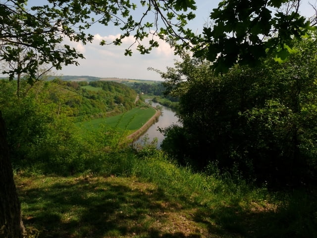
Eine schöne Wanderung auf dem Lahnhöhenweg links der Lahn von Villmar nach Runkel. Der Weg führt auf dem Lahnhöhenweg teilweise auf schmalen Pfaden am Hang zur Lahn, ist aber jederzeit gut zu gehen. Immerwieder öffnen sich neue Aussichten auf die Lahn und das Lahntal. Der Rückweg führt auf dem Lahnradweg, R7, von Runkel nach Villmar.


Galeria trasy

Mapa trasy i profil wysokości

  • Open Street Map
  • Google
Minimum height 115 m Maximum height 180 m Widok szczegółowy

More about the tour author

Arno Brueck
Member since 2007

Send private message

Komentarze

Gestartet sind wir in Villmar an der Lahn zwischen Weilburg und Limburg. Bitte beachten, dass Villmar eine Großgemeinde mit mehreren Ortsteilen ist. Also Start in Villmar selbst.

GPS tracks

Trackpoints
  • GPX / Garmin Map Source (gpx) download
  • TCX / Garmin Training Center® (tcx) download
  • CRS / Garmin Training Center® (crs) download
  • Google Earth (kml) download
  • G7ToWin (g7t) download
  • TTQV (trk) download
  • Overlay (ovl) download
  • Fugawi (txt) download
  • Kompass (DAV) Track (tk) download
  • Karta trasy (pdf) download
  • Original file of the author (gpx) download

More about the tour author

Arno Brueck
Member since 2007

Send private message
Share track
Add to my favorites
Remove from my favorites
Edit tags
My score
Rate
Trasa: Lahnhöhenweg von Villmar nach Runkel
Rodzaj: Wędrówki
Długość: 10,3 km
Evaluated on:
Czas trwania:
Day(s)
Hour(s)
Minute(s)
Ocena: Krajobraz Czynnik zadowolenia Kondycja Technika