Login

Zapomniałeś swój login?

Cookies have to be accepted!
Your browser's cookie functionality is disabled. Please enable this functionality.

Not a member yet?

Register now
Login

Available for registred users only

Log in to use this feature.

Zapomniałeś swój login?

Cookies have to be accepted!
Your browser's cookie functionality is disabled. Please enable this functionality.

Not a member yet?

Register now
Filter
Kategorie
Advanced filters
  • Długość (km)
  • Wysokość
Zapisz filtr Reset filter

TrackRank

QRCode

Technical data

Długość12,0 km Wysokość395 m Way down407 m Czas trwania04:00 h:m Data03.05.2009
Oceny Author Krajobraz Czynnik zadowolenia Kondycja Technika

Statystyka

1883 Widoki 1 Ocena 205 Downloads / Pliki do pobrania 5.00 Przeciętnie
Rate
  • Karta trasy
  • Dojazd
  • Downloads / Pliki do pobrania
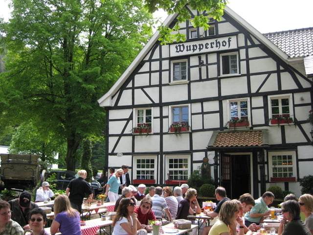
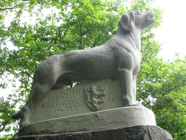
Wanderweg teilweise auf schmalen Pfaden mit teilweiser erheblicher Steigung. Unterwegs streifen wir den Wupperhof, ein Ausflugslokal mit schönem Biergarten, und den Rüdenstein. Nach der Durchquerung des Ortes Orth / Wolfstal wandern wir durch ein romansches Bachtal zurück nach Glüder.

Galeria trasy

Mapa trasy i profil wysokości

  • Open Street Map
  • Google
Minimum height 69 m Maximum height 239 m Widok szczegółowy

More about the tour author

Heihopser
Member since 2009

Send private message

Komentarze

Anfahrt über A1, Ausfahrt Burscheid dann über Witzhelden nach Glüder (Parkplatz der Geschlossenen Gaststätte)

GPS tracks

Trackpoints
  • GPX / Garmin Map Source (gpx) download
  • TCX / Garmin Training Center® (tcx) download
  • CRS / Garmin Training Center® (crs) download
  • Google Earth (kml) download
  • G7ToWin (g7t) download
  • TTQV (trk) download
  • Overlay (ovl) download
  • Fugawi (txt) download
  • Kompass (DAV) Track (tk) download
  • Karta trasy (pdf) download
  • Original file of the author (gpx) download

More about the tour author

Heihopser
Member since 2009

Send private message
Share track
Add to my favorites
Remove from my favorites
Edit tags
My score
Rate
Trasa: Rundwanderung an der Wupper
Rodzaj: Wędrówki
Długość: 12,0 km
Evaluated on:
Czas trwania:
Day(s)
Hour(s)
Minute(s)
Ocena: Krajobraz Czynnik zadowolenia Kondycja Technika