


Chira
Dienstag, 9.30 - 16.00 Uhr, reine Fahrzeit ca. 3h
Level 1, 40 km, 300 hm auf, 1500 hm
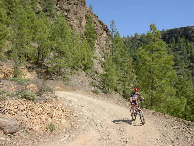
Traumhafte Kulisse inmitten kanarischer Kiefernwälder - mit Fahrtechnik-Schulung - vorbei am Chira-Stausee - erlerntes im Gelände anwenden - Fahrspaß und Landschaft begeistern uns!
Dienstag, 9.30 - 16.00 Uhr, reine Fahrzeit ca. 3h
Level 1, 40 km, 300 hm auf, 1500 hm
Traumhafte Kulisse inmitten kanarischer Kiefernwälder - mit Fahrtechnik-Schulung - vorbei am Chira-Stausee - erlerntes im Gelände anwenden - Fahrspaß und Landschaft begeistern uns!
Further information at
http://www.free-motion.net/fm/de/tours.phpGaleria trasy
Mapa trasy i profil wysokości
Minimum height 26 m
Maximum height 1277 m
More about the tour author

|
winklem |
Komentarze
Start am Free Motion Center in der Avda. de Alfereces Provisionales
GPS tracks
Trackpoints-
GPX / Garmin Map Source (gpx) download
-
TCX / Garmin Training Center® (tcx) download
-
CRS / Garmin Training Center® (crs) download
-
Google Earth (kml) download
-
G7ToWin (g7t) download
-
TTQV (trk) download
-
Overlay (ovl) download
-
Fugawi (txt) download
-
Kompass (DAV) Track (tk) download
-
Karta trasy (pdf) download
-
Original file of the author (g7t) download
More about the tour author
|
|
winklem |
Add to my favorites
Remove from my favorites
Edit tags
Open track
My score
Rate
super für Anfänger!