


Tour grösstenteils auf Forstpisten und Asphalt, im Durchschnitt ca. 10% Steigung. Im oberen Teil steiler, bis zu 17%, auf einem Almweg mit lockerem Untergrund.
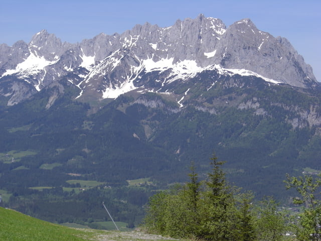
Sehr schönes Panorama auf der gesamten Tour.
Variationen:
- ohne den Abstecher zum Ghf. Harschbichl
- Auffahrt über Ghf. Buchwiesen, Cafe Koasaburg, Ghf. Angereralm.
- Abfahrt über Müllneralm nach Oberndorf.
Rast:
Meiner Meinung nach am Besten auf der Stanglalm. Viele Andere auf kurzen Abstechern erreichbar.
Galeria trasy
Mapa trasy i profil wysokości
Minimum height 674 m
Maximum height 1593 m
More about the tour author

|
mfa69 |
Komentarze

Von München kommend auf der A8 Richtung Salzburg bis zum Inntaldreieck, dort auf der A93 Richtung Kufstein / Innsbruck. Bis Kufstein-Süd ( mautfrei ) und von dort auf der B178 immer Richtung Ellmau / St.Johann usw. bis St.Johann.
In St.Johann zum Parkplatz der Harschbichlbahn.
In St.Johann zum Parkplatz der Harschbichlbahn.
GPS tracks
Trackpoints-
GPX / Garmin Map Source (gpx) download
-
TCX / Garmin Training Center® (tcx) download
-
CRS / Garmin Training Center® (crs) download
-
Google Earth (kml) download
-
G7ToWin (g7t) download
-
TTQV (trk) download
-
Overlay (ovl) download
-
Fugawi (txt) download
-
Kompass (DAV) Track (tk) download
-
Karta trasy (pdf) download
-
Original file of the author (gpx) download
More about the tour author
|
|
mfa69 |
Add to my favorites
Remove from my favorites
Edit tags
Open track
My score
Rate