

Nicht geegnet an Wochenenden (viele Wanderer)
Abwechslungsreiche, fahrtechnisch herausfordernde Tour rund um den Hornbachgraben. Ich bin auf dem Ahorn gestartet, besser wäre sicher Wasen i.E.
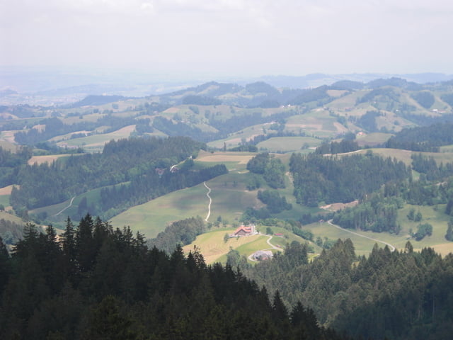
Fahrt ab Ahorn Richtung Fritzenfluh. Auf Bärhegenchnübeli verlässt man den Grat und fährt in den Wasen. Anschliessend steigt die Strasse nach Chnubel steil an, um in ein - an heissen Tagen willkommenes- bewaldetes Gebiet zu führen. Bei Hinterarni überrascht ein toller Ausblick in den Nachbarkanton Luzern. Das Gelände und die Wege sind recht schwierig, Wurzeln und loses Geröll verlangen über längere Distanz konzentriertes Fahren. Den Hochänzi wetlich umfahrend, folgen abwechselnd Naturstrassen, Karr- und Wanderwege dem Grat entlang zurück zum Ahorn.
Viele Restaurants zum empfehlen:
Ahor, Brestenegg, Fritzenfluh, Kuttlenbad, Hinterarni, Lushütte, Naturfreundehaus
Galeria trasy


Mapa trasy i profil wysokości
Minimum height 752 m
Maximum height 1335 m
More about the tour author
|
|
resinfield |
Komentarze

GPS tracks
Trackpoints-
GPX / Garmin Map Source (gpx) download
-
TCX / Garmin Training Center® (tcx) download
-
CRS / Garmin Training Center® (crs) download
-
Google Earth (kml) download
-
G7ToWin (g7t) download
-
TTQV (trk) download
-
Overlay (ovl) download
-
Fugawi (txt) download
-
Kompass (DAV) Track (tk) download
-
Karta trasy (pdf) download
-
Original file of the author (gpx) download
More about the tour author
|
|
resinfield |
Add to my favorites
Remove from my favorites
Edit tags
Open track
My score
Rate