

Deze tocht start in Mechelen waarna we richting Dalbissen/Epen gaan en vandaar naar het Gulpenerbos lang de golfbaan.
Van hier uit voert de tocht naar het Bovenste Bos in Heijenrath,waarna we afdalen naar het plaatsje Terziet.
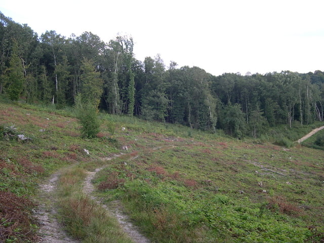
Dan gaat de tocht via een weidepad (Let Op!! Wandelaars) langs de heijmansgroeve,waarna we uitkomen kort bij het belgische Sippenaeken.
Vandaar uit klimmen we naar Cottessen, langs de camping volgt een langere klim langs het huis van Dokter Huijben,met zijn schotse hooglanders in de wei,komen we uit in het vijlenerbos.
Van hier uit biken we naar het 3 landenpun in Vaals,met net voor het 3 landenpunt een zeer steile singeltrackklim.
Daarna voert de tocht door het Akenerbos weer terug naar het 3 landenpunt.
Waarna we via het vijlenerbos/elzetterbos weer terug in mechelen komen.
Er zitten meerdere mooie singletracks in deze tocht.
Succes en happy bikingfun!!
This excursion starts Dalbissen/Epen in Mechelen where upon we direction goes and hence to the Gulpenerbos long the golf job. Of here from the excursion conducts to the upper bunch in Heijenrath, where upon we descend to the little town Terziet. Then the excursion goes by means of a meadow path (pay attention to!! Walkers) along the heijmansgroeve, whereupon we briefly end up at the Belgian Sippenaeken. Hence from we climb to Cottessen, along the camp-site a longer klim follows along the house of doctor Huijben, with its Scottish higlanders in the grass, ends up we in the vijlenerbos. Of chipping we to 3 the landenpun in faded, singeltrackklim very with for 3 the country point steep. Afterwards the excursion carries back by the Akenerbos to 3 the country point. Where upon we by means of the vijlenerbos/elzetterbos in mechelen return. There several beautiful singletracks in this excursion sit. Happy bikingfun!!
Diese tour beginnt Dalbissen/Epen in Mechelen, worauf wir Richtung zum Gulpenerbos lang der Golfjob gehen. Von hier von den Exkursionsführungen zum oberen Bündel in Heijenrath, worauf wir zum ort Terziet absteigen. Dann geht die Exkursion mittels eines Wiesenweges (Lohnaufmerksamkeit zu!! Wanderer) entlang dem heijmansgroeve, worauf wir kurz oben beim belgischen Sippenaeken beenden. Folglich von klettern uns zu Cottessen, entlang dem Campingplatz, den ein längeres klim entlang das Haus des Doktors Huijben folgt, mit seinen schottischen highlanders in die Wiese, beenden oben uns in den vijlenerbos. Von, abbrechend uns bis 3 das landereck, in sehr verblassen, singeltracksteigung ser steil.. Danach trägt die Exkursion zurück durch den Aachenerwald bis 3 den Landpunkt. Worauf wir mittels des vijlenerbos/elzetterbos innen Rückkehr mechelen. Dort sitzen einige schöne singletracks in dieser Exkursion. Erfolg und glückliches bikingfun!!
Galeria trasy


Mapa trasy i profil wysokości
Minimum height 96 m
Maximum height 348 m
More about the tour author
|
|
BertAusten |
Komentarze

Commandeurstraat ,6281 AM Mechelen
GPS tracks
Trackpoints-
GPX / Garmin Map Source (gpx) download
-
TCX / Garmin Training Center® (tcx) download
-
CRS / Garmin Training Center® (crs) download
-
Google Earth (kml) download
-
G7ToWin (g7t) download
-
TTQV (trk) download
-
Overlay (ovl) download
-
Fugawi (txt) download
-
Kompass (DAV) Track (tk) download
-
Karta trasy (pdf) download
-
Original file of the author (gpx) download
More about the tour author
|
|
BertAusten |
Add to my favorites
Remove from my favorites
Edit tags
Open track
My score
Rate