Login

Zapomniałeś swój login?

Cookies have to be accepted!
Your browser's cookie functionality is disabled. Please enable this functionality.

Not a member yet?

Register now
Login

Available for registred users only

Log in to use this feature.

Zapomniałeś swój login?

Cookies have to be accepted!
Your browser's cookie functionality is disabled. Please enable this functionality.

Not a member yet?

Register now
Filter
Kategorie
Advanced filters
  • Długość (km)
  • Wysokość
Zapisz filtr Reset filter

TrackRank

QRCode

Technical data

Długość4,1 km Wysokość873 m Way down10 m Czas trwania02:30 h:m Data16.06.2009
Oceny Author Krajobraz Czynnik zadowolenia Kondycja Technika

Statystyka

1720 Widoki 1 Ocena 188 Downloads / Pliki do pobrania 5.00 Przeciętnie
Rate
  • Karta trasy
  • Dojazd
  • Downloads / Pliki do pobrania

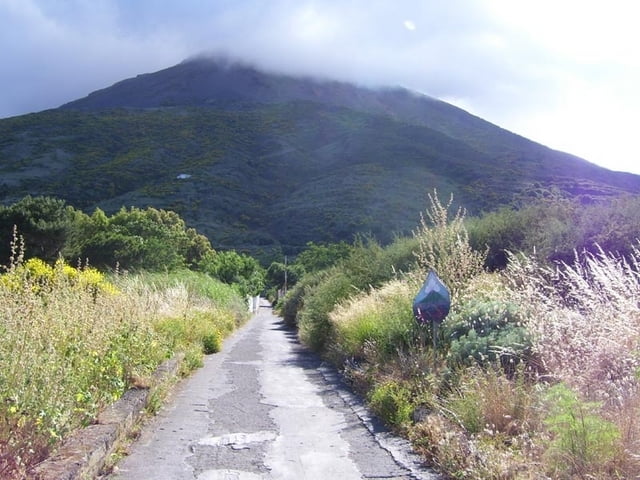
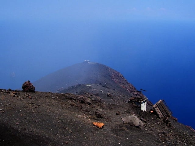
Aufstieg von Stomboli-Ort zum höchsten Punkt am Krater. (Ist nicht der höchste Punkt der Insel)

Von den Schutzständen am Grat lassen sich die Eruptionen - vor allem bei Nacht - gut beobachten.

Technisch unschwierig, mit festen Turnschuhen begehbar, aber die Gefahren des Vulkans beachten: Eruptionen, Schwefelgase, Sturm, Sandsturm, Hitze, Kälte, Verirren im Nebel...

Aufstieg soll ohne Führer angeblich verboten sein.

Unbedingt mitnehmen pro Person:

1l Wasser, (Am besten: Taucher-)Brille gegen Sand, Pullover(auch wenn's unten noch so heiß ist), winddichte Kleidung, Mütze, Handschuhe, Taschenlampe. Man muss unter Umständen mehr als 1 Stunde auf einen Ausbruch warten, dabei wird's im Sturm sehr schnell kalt. Ev. Schlafsack mitbringen! Übernachten ist definitiv verboten.

Galeria trasy

Mapa trasy i profil wysokości

  • Open Street Map
  • Google
Minimum height 47 m Maximum height 923 m Widok szczegółowy

More about the tour author

hans-lauber
Member since 2009

Send private message

Komentarze

japa-fi on 22.08.2014

Must see

If you can handle the ascent, then I recommend taking this tour. It's not that often one can get on top of active volcano at sunset to enjoy the views. Unfortunately for me, the volcano was having a less active period, but still experience to remember.
Von der Kirche geht östlich gleich neben einer Apotheke ein Weg los. Zum Gipfel nicht beschildert.

GPS tracks

Trackpoints
  • GPX / Garmin Map Source (gpx) download
  • TCX / Garmin Training Center® (tcx) download
  • CRS / Garmin Training Center® (crs) download
  • Google Earth (kml) download
  • G7ToWin (g7t) download
  • TTQV (trk) download
  • Overlay (ovl) download
  • Fugawi (txt) download
  • Kompass (DAV) Track (tk) download
  • Karta trasy (pdf) download
  • Original file of the author (gpx) download

More about the tour author

hans-lauber
Member since 2009

Send private message
Share track
Add to my favorites
Remove from my favorites
Edit tags
My score
Rate
Trasa: Stromboli Aufstieg
Rodzaj: Wędrówki
Długość: 4,1 km
Evaluated on:
Czas trwania:
Day(s)
Hour(s)
Minute(s)
Ocena: Krajobraz Czynnik zadowolenia Kondycja Technika