Login

Zapomniałeś swój login?

Cookies have to be accepted!
Your browser's cookie functionality is disabled. Please enable this functionality.

Not a member yet?

Register now
Login

Available for registred users only

Log in to use this feature.

Zapomniałeś swój login?

Cookies have to be accepted!
Your browser's cookie functionality is disabled. Please enable this functionality.

Not a member yet?

Register now
Filter
Kategorie
Advanced filters
  • Długość (km)
  • Wysokość
Zapisz filtr Reset filter

TrackRank

QRCode

Technical data

Długość95,1 km Wysokość5415 m Way down5876 m Czas trwania00:00 h:m Data16.06.2009
Oceny Author Krajobraz Czynnik zadowolenia Kondycja Technika

Statystyka

1216 Widoki Oceny 250 Downloads / Pliki do pobrania Przeciętnie
Rate
  • Karta trasy
  • Dojazd
  • Downloads / Pliki do pobrania

Absoluter Traum diese Region !

Tag 1: Seiseralmbahn bis Tierseralpl (www.tierseralpl.com)

Tag 2: Tierseralpl über refugio Bolzano (www.schlernhaus.com) nach Plattkofelalm (www.plattkofel.com)

Tag 3: Aufstieg zu Fuss bis zum Plattekofel (2953 m)

Nachmittag Umfahrung vom Plattekofel 

Tag 4 :Tierseralpl / Rif Bolzano / Prügelweg /Seiseralmbahn
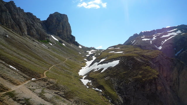
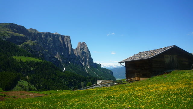
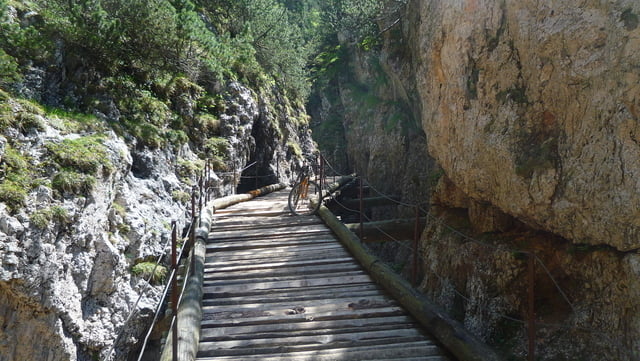
Galeria trasy

Mapa trasy i profil wysokości

  • Open Street Map
  • Google
Minimum height 923 m Maximum height 2968 m Widok szczegółowy

More about the tour author

laviper88
Member since 2008

Send private message

Komentarze

klemid on 10.07.2009

Track roh

Die Tour mag ja schön sein, aber den Track hättest Du gerne noch etwas nachpflegen können.
Phil_888 on 05.10.2010

Top!!

Dieses Tour bin ich schon gefahren, ich kann nur bestätigen: TOP Tour! :o)
Start in Castelrotto (Seiseralmbahn)

GPS tracks

Trackpoints
  • GPX / Garmin Map Source (gpx) download
  • TCX / Garmin Training Center® (tcx) download
  • CRS / Garmin Training Center® (crs) download
  • Google Earth (kml) download
  • G7ToWin (g7t) download
  • TTQV (trk) download
  • Overlay (ovl) download
  • Fugawi (txt) download
  • Kompass (DAV) Track (tk) download
  • Karta trasy (pdf) download
  • Original file of the author (gpx) download

More about the tour author

laviper88
Member since 2008

Send private message
Share track
Add to my favorites
Remove from my favorites
Edit tags
My score
Rate
Trasa: 4 Tage Seiseralmtour
Rodzaj: Rower górski (MTB)
Długość: 95,1 km
Evaluated on:
Czas trwania:
Day(s)
Hour(s)
Minute(s)
Ocena: Krajobraz Czynnik zadowolenia Kondycja Technika