Login

Zapomniałeś swój login?

Cookies have to be accepted!
Your browser's cookie functionality is disabled. Please enable this functionality.

Not a member yet?

Register now
Login

Available for registred users only

Log in to use this feature.

Zapomniałeś swój login?

Cookies have to be accepted!
Your browser's cookie functionality is disabled. Please enable this functionality.

Not a member yet?

Register now
Filter
Kategorie
Advanced filters
  • Długość (km)
  • Wysokość
Zapisz filtr Reset filter

TrackRank

QRCode

Technical data

Długość17,5 km Wysokość475 m Way down466 m Czas trwania01:30 h:m Data19.06.2009
Oceny Author Krajobraz Czynnik zadowolenia Kondycja Technika

Statystyka

736 Widoki Oceny 104 Downloads / Pliki do pobrania Przeciętnie
Rate
  • Karta trasy
  • Dojazd
  • Downloads / Pliki do pobrania

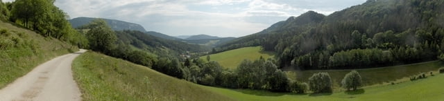
Die offizielle Dürrnberg-Mountainbike-Strecke. Beginnt bei der Wellneswelt in Wüflach

Ich bin sie hier in der anderen Richtung gefahren, bitte nicht wundern!

Further information at

http://www.dowalil.net

Galeria trasy

Mapa trasy i profil wysokości

  • Open Street Map
  • Google
Minimum height 402 m Maximum height 789 m Widok szczegółowy

More about the tour author

herbydow
Member since 2008

Send private message

Komentarze

GPS tracks

Trackpoints
  • GPX / Garmin Map Source (gpx) download
  • TCX / Garmin Training Center® (tcx) download
  • CRS / Garmin Training Center® (crs) download
  • Google Earth (kml) download
  • G7ToWin (g7t) download
  • TTQV (trk) download
  • Overlay (ovl) download
  • Fugawi (txt) download
  • Kompass (DAV) Track (tk) download
  • Karta trasy (pdf) download
  • Original file of the author (gpx) download

More about the tour author

herbydow
Member since 2008

Send private message
Share track
Add to my favorites
Remove from my favorites
Edit tags
My score
Rate
Trasa: Dürrnberg Strecke
Rodzaj: Rower górski (MTB)
Długość: 17,5 km
Evaluated on:
Czas trwania:
Day(s)
Hour(s)
Minute(s)
Ocena: Krajobraz Czynnik zadowolenia Kondycja Technika