


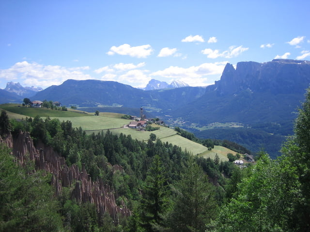
Sehr schöne Genusstour auf dem Ritten.
Von hier aus hat man eine herrliche Bergsicht auf den Schlern, Rosengarten, Latemar usw..
Mit der Bahnfahrt und den Pausen ergibt sich eine wunderbare Tagetour.
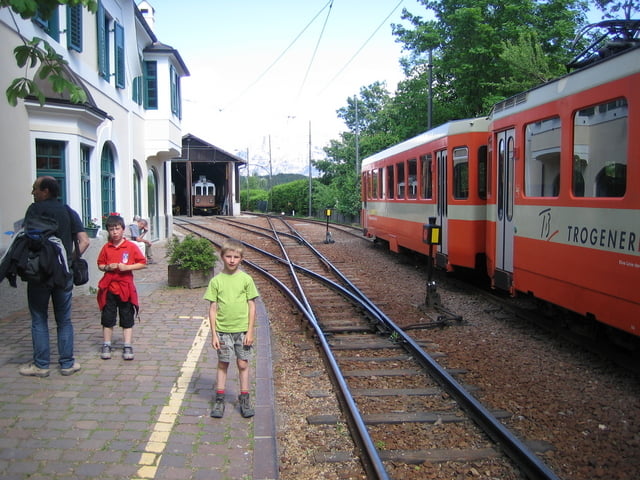
Wir sind von Klobenstein aus gestartet. Man kann aber auch mit der Seilbahn von Bozen nach Oberbozen fahren und dann in die Schwalspurbahn umsteigen. Die Bahnfahrt sind ca. 5km. Man kann diese Strecke natürlich auch wandern. Aber die histrorische Schmalspurbahn ist schon ein tolles Erlebnis.
Further information at
http://www.ritten.com/100jahrerittnerbahn/fahrplan.htmGaleria trasy


Mapa trasy i profil wysokości
Minimum height 1131 m
Maximum height 1383 m
More about the tour author
|
|
Tom19 |
Komentarze

siehe Daten.
Von Bozen fährt man mit dem Auto hinauf nach Klobenstein.
Oder wie oben beschrieben mit der Seilbahn nach Oberbozen.
GPS tracks
Trackpoints-
GPX / Garmin Map Source (gpx) download
-
TCX / Garmin Training Center® (tcx) download
-
CRS / Garmin Training Center® (crs) download
-
Google Earth (kml) download
-
G7ToWin (g7t) download
-
TTQV (trk) download
-
Overlay (ovl) download
-
Fugawi (txt) download
-
Kompass (DAV) Track (tk) download
-
Karta trasy (pdf) download
-
Original file of the author (gpx) download
More about the tour author
|
|
Tom19 |
Add to my favorites
Remove from my favorites
Edit tags
Open track
My score
Rate