
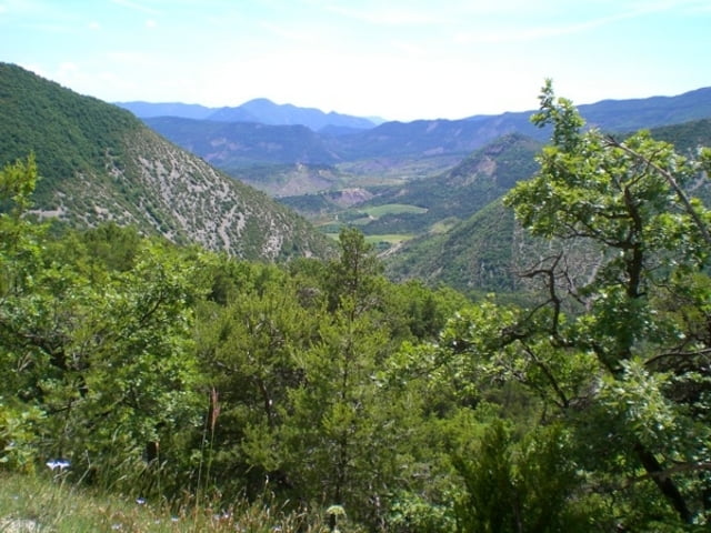

Eine Supertour durch das einsame Hinterland von Saint-Ferreol-30-Pas.
Auffahrt auf Asphaltstrasse durch schöne Schlucht. Nach Abzweig auf Forststrasse weiter bis Col Aimont. Hier beginnt eine wunderschöne Trailabfahrt bis zum Weiler Langirard. Im Tal bei Condorcet angekommen kann man die Tour auch über die direkt Rückfahrt auf der D.. nach St. Ferreol abkürzen. Wer sich die Strasse bis Léchalette und über einen steilen Karrenweg weiter bis Pied de Reyssas hochmüht, wird mit einem weitere schönen Waldtrail belohnt. Der Waldtrail ist im unteren Teil vom lokalen VTT Club zu einem kleinen Bikepark ausgebaut.
Der Track entspricht der Tour 6 des Guides „VTT Drome Provencal Est“ erhältlich in der Tourist Info in Nyons und im Buchhandel.
Die Tour ist mit den üblichen VTT Schildern gut ausgeschildert und kann problemlos auch ohne GPS gefahren werden.
Start der Tour am besten in Saint-Ferreol-30-Pas. Parken auf dem offiziellen, ausgeschilderten Parkplatz.
Die Auberge in St. Ferreol ist der lokale "Site VTT". Hier bekommt Ihr gute Infos zu den weiteren Touren der Gegend.
Further information at
http://www.dromevtt.com/Galeria trasy

Mapa trasy i profil wysokości
Minimum height 345 m
Maximum height 856 m
More about the tour author

|
verzascat |
Komentarze

GPS tracks
Trackpoints-
GPX / Garmin Map Source (gpx) download
-
TCX / Garmin Training Center® (tcx) download
-
CRS / Garmin Training Center® (crs) download
-
Google Earth (kml) download
-
G7ToWin (g7t) download
-
TTQV (trk) download
-
Overlay (ovl) download
-
Fugawi (txt) download
-
Kompass (DAV) Track (tk) download
-
Karta trasy (pdf) download
-
Original file of the author (gpx) download
More about the tour author
|
|
verzascat |
Add to my favorites
Remove from my favorites
Edit tags
Open track
My score
Rate