


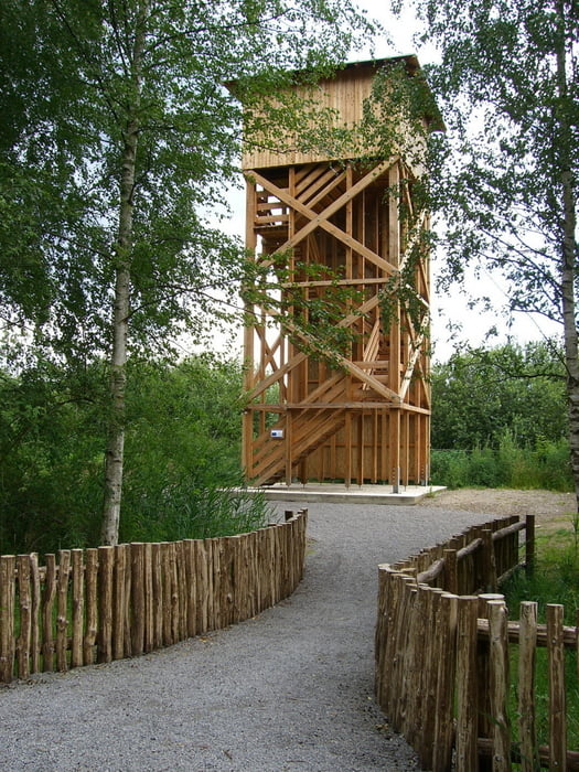
Von Wolfsburg aus geht diese Tour ins Naturschutzgebiet Ilkerbruch. Wir fahren am Mittellandkanal Richtung Fallersleben zur Schleuse Sülfeld, wo wir kurz vorher dann zum Naturschutzgebiet abbiegen. Hier stehen mehrere Stationen bereit für das Projekt>>Natur erleben<<, wo man Konik-Pferde, Auerochsen und verschiedene Vogelarten beobachten können. Auf dem 12,5 Meter hohen Aussichtsturm lässt sich alles aus einer anderen Perspektive beobachten. Diese Tour ist hin und zurück ca. 20 km lang, der Erlebnispfad ist ca. 6,3 km lang.
Further information at
http://www.wolfsburg-gps-tour.deGaleria trasy
Mapa trasy i profil wysokości
Minimum height 44 m
Maximum height 112 m
More about the tour author
|
|
KlausWob |
Komentarze

Die Tour fängt in Wolfsburg in der Grauhorststr. an.
schön als Fotoshow anzuschauen
siehe link
diese und weitere
unter
anzuschauen
viel Spaß beim nachfahren.
GPS tracks
Trackpoints-
GPX / Garmin Map Source (gpx) download
-
TCX / Garmin Training Center® (tcx) download
-
CRS / Garmin Training Center® (crs) download
-
Google Earth (kml) download
-
G7ToWin (g7t) download
-
TTQV (trk) download
-
Overlay (ovl) download
-
Fugawi (txt) download
-
Kompass (DAV) Track (tk) download
-
Karta trasy (pdf) download
-
Original file of the author (gpx) download
More about the tour author
|
|
KlausWob |
Add to my favorites
Remove from my favorites
Edit tags
Open track
My score
Rate