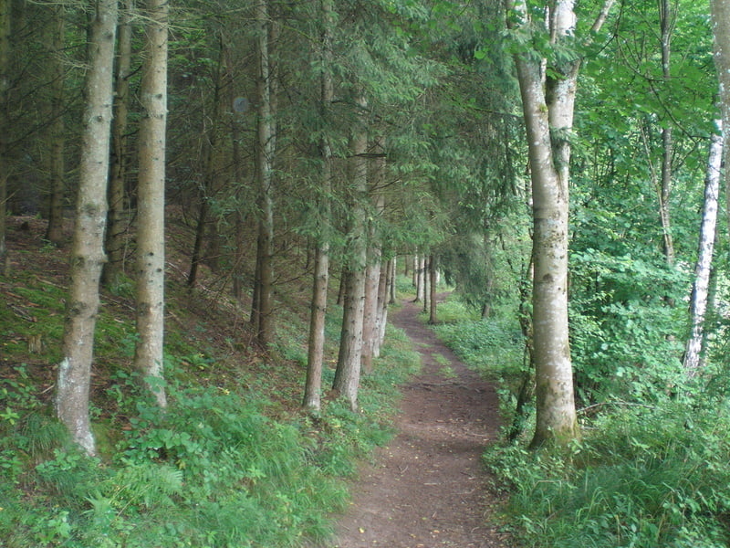
Login

Zapomniałeś swój login?

Cookies have to be accepted!
Your browser's cookie functionality is disabled. Please enable this functionality.

Not a member yet?

Register now
Login

Available for registred users only

Log in to use this feature.

Zapomniałeś swój login?

Cookies have to be accepted!
Your browser's cookie functionality is disabled. Please enable this functionality.

Not a member yet?

Register now
Filter
Kategorie
Advanced filters
  • Długość (km)
  • Wysokość
Zapisz filtr Reset filter

TrackRank

QRCode

Technical data

Długość12,6 km Wysokość566 m Way down571 m Czas trwania03:30 h:m Data11.07.2009
Oceny Author Krajobraz Czynnik zadowolenia Kondycja Technika

Statystyka

963 Widoki Oceny 187 Downloads / Pliki do pobrania Przeciętnie
Rate
  • Karta trasy
  • Dojazd
  • Downloads / Pliki do pobrania

Galeria trasy

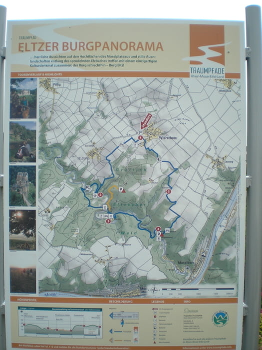
Mapa trasy i profil wysokości

  • Open Street Map
  • Google
Minimum height 75 m Maximum height 302 m Widok szczegółowy

More about the tour author

Heinrichs
Member since 2007

Send private message

Komentarze

Anfahrtbeschreibung findet Ihr unter http://maps.google.de/maps?hl=de&tab=wl   wenn Ihr dort die Koordinaten N50 13.552 E7 20.854 eingebt

GPS tracks

Trackpoints
  • GPX / Garmin Map Source (gpx) download
  • TCX / Garmin Training Center® (tcx) download
  • CRS / Garmin Training Center® (crs) download
  • Google Earth (kml) download
  • G7ToWin (g7t) download
  • TTQV (trk) download
  • Overlay (ovl) download
  • Fugawi (txt) download
  • Kompass (DAV) Track (tk) download
  • Karta trasy (pdf) download
  • Original file of the author (gpx) download

More about the tour author

Heinrichs
Member since 2007

Send private message
Share track
Add to my favorites
Remove from my favorites
Edit tags
My score
Rate
Trasa: Eltzer Burgpanorama
Rodzaj: Wędrówki
Długość: 12,6 km
Evaluated on:
Czas trwania:
Day(s)
Hour(s)
Minute(s)
Ocena: Krajobraz Czynnik zadowolenia Kondycja Technika