Login

Zapomniałeś swój login?

Cookies have to be accepted!
Your browser's cookie functionality is disabled. Please enable this functionality.

Not a member yet?

Register now
Login

Available for registred users only

Log in to use this feature.

Zapomniałeś swój login?

Cookies have to be accepted!
Your browser's cookie functionality is disabled. Please enable this functionality.

Not a member yet?

Register now
Filter
Kategorie
Advanced filters
  • Długość (km)
  • Wysokość
Zapisz filtr Reset filter

TrackRank

QRCode

Technical data

Długość44,6 km Wysokość977 m Way down972 m Czas trwania01:40 h:m Data13.07.2009
Oceny Author Krajobraz Czynnik zadowolenia Kondycja Technika

Statystyka

281 Widoki Oceny 22 Downloads / Pliki do pobrania Przeciętnie
Rate
  • Karta trasy
  • Dojazd
  • Downloads / Pliki do pobrania

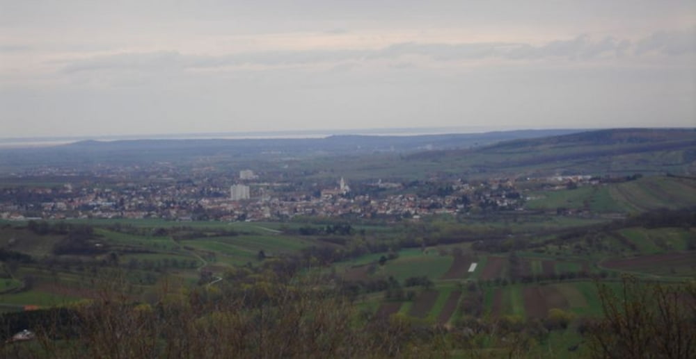
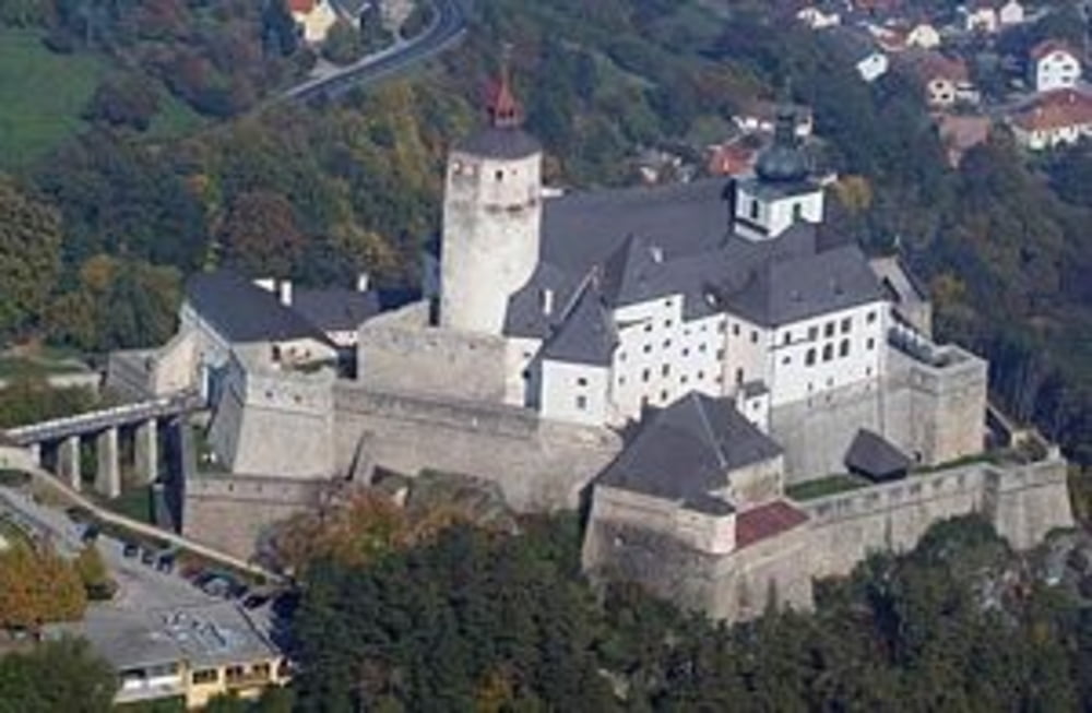
Die Tour beginnt in Mattersburg und geht üder die Burg Forchtenstein auf die Rosalia, hier hat man dann schon 7km Bergfahren in den Knochen.

Nach einigen Hügeln vorbei an Hochwolkersdorf erfolgt eine rasante Abfart Richtung Schwarzenbach garniert mit gefinkelten Serpentinen, an die in Richtung Sieggraben eine  langgezogene Steigung folgt.

Kurz nach der Ortstafel von Sieggraben kommt nochmal eine schnelle Abfahrt und es geht auf einer langen geraden direkt in Richtung Mattersburg. 

Galeria trasy

Mapa trasy i profil wysokości

  • Open Street Map
  • Google
Minimum height 241 m Maximum height 724 m Widok szczegółowy

More about the tour author

Havli
Member since 2009

Send private message

Komentarze

GPS tracks

Trackpoints
  • GPX / Garmin Map Source (gpx) download
  • TCX / Garmin Training Center® (tcx) download
  • CRS / Garmin Training Center® (crs) download
  • Google Earth (kml) download
  • G7ToWin (g7t) download
  • TTQV (trk) download
  • Overlay (ovl) download
  • Fugawi (txt) download
  • Kompass (DAV) Track (tk) download
  • Karta trasy (pdf) download
  • Original file of the author (gpx) download

More about the tour author

Havli
Member since 2009

Send private message
Share track
Add to my favorites
Remove from my favorites
Edit tags
My score
Rate
Trasa: Schwarzenbachrunde
Rodzaj: Rower szosowy
Długość: 44,6 km
Evaluated on:
Czas trwania:
Day(s)
Hour(s)
Minute(s)
Ocena: Krajobraz Czynnik zadowolenia Kondycja Technika