
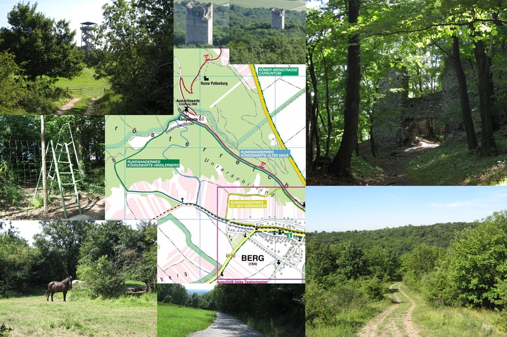

Parkplatz "Am Bühel" in Berg.
Wanderung über Straße zur Kapelle, Wanderweg "grün" an mit Steinen errichteten Schützengraben aus dem ersten Weltkrieg vorbei Richtung Königswarte (um Spende EUR 1,00 wird ersucht).
Rechterhand über Wildzaunleiter auf befestigeter Straße zur Abzweigung Pottenburg.
Romantischer Weg zur Pottenburg (größer als erwartet. ähnlich Scharfeneck, hoher Burgfried). In Ruine auf Wildschwein gestoßen (schlief im Burgfried). Retour zur Leiter quer-feld-ein.
Über Koppeln zum Hindlerberg. Richtung Berg retour über Radweg und an Weinrieden vorbei. Richtung "Altes Haus'" und dann am Hang entlang zur "gelben" Route bis zum "grünen" Weg, dann zur Kapelle und wieder zum Auto.
Mapa trasy i profil wysokości
Minimum height 140 m
Maximum height 330 m
More about the tour author
|
|
huberj59 |
Komentarze

A6 oder B50
GPS tracks
Trackpoints-
GPX / Garmin Map Source (gpx) download
-
TCX / Garmin Training Center® (tcx) download
-
CRS / Garmin Training Center® (crs) download
-
Google Earth (kml) download
-
G7ToWin (g7t) download
-
TTQV (trk) download
-
Overlay (ovl) download
-
Fugawi (txt) download
-
Kompass (DAV) Track (tk) download
-
Karta trasy (pdf) download
-
Original file of the author (gpx) download
More about the tour author
|
|
huberj59 |
Add to my favorites
Remove from my favorites
Edit tags
Open track
My score
Rate