

Die Tour führt vom Parkplatz der Hochriesbahn zum Berggasthof Duftbräu. Von dort an geht es über einsame, gut befahrbare Wirtschaftwege in Richtung Frasdorfer Hütte. An der Südseite der Hochries gibt es ein kurzes Schiebstück. Danach gibt es wunderschöne Aussichtspunkte Richtung Chiemsee und Samerberg!
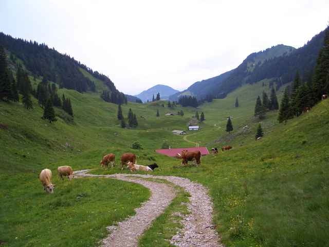
Es werden einige Almen mit Viehtrieb gequert. Bitte Geschwindigkeit anpassen!
Es werden einige Almen mit Viehtrieb gequert. Bitte Geschwindigkeit anpassen!
Galeria trasy

Mapa trasy i profil wysokości
Minimum height 706 m
Maximum height 1274 m
More about the tour author

|
eaglefly |
Komentarze

A8 von München Richtung Salzburg, Autobahnabfahrt Achenmühle abfahren und nach Achenmühle abbiegen. In Achenmühle ist bereits die "Hochriesbahn" ausgeschildert. Den Schildern folgen bis zum Parkplatz. Der Parkplatz direkt an der Talstation ist kostenpflichtig, unterhalb des Tennisplatzes in westliche Richtung befindet sich noch ein gebührenfreier Parkplatz.
GPS tracks
Trackpoints-
GPX / Garmin Map Source (gpx) download
-
TCX / Garmin Training Center® (tcx) download
-
CRS / Garmin Training Center® (crs) download
-
Google Earth (kml) download
-
G7ToWin (g7t) download
-
TTQV (trk) download
-
Overlay (ovl) download
-
Fugawi (txt) download
-
Kompass (DAV) Track (tk) download
-
Karta trasy (pdf) download
-
Original file of the author (gpx) download
More about the tour author
|
|
eaglefly |
Add to my favorites
Remove from my favorites
Edit tags
Open track
My score
Rate