Login

Zapomniałeś swój login?

Cookies have to be accepted!
Your browser's cookie functionality is disabled. Please enable this functionality.

Not a member yet?

Register now
Login

Available for registred users only

Log in to use this feature.

Zapomniałeś swój login?

Cookies have to be accepted!
Your browser's cookie functionality is disabled. Please enable this functionality.

Not a member yet?

Register now
Filter
Kategorie
Advanced filters
  • Długość (km)
  • Wysokość
Zapisz filtr Reset filter

TrackRank

QRCode

Technical data

Długość54,0 km Wysokość1523 m Way down1522 m Czas trwania04:00 h:m Data08.08.2009
Oceny Author Krajobraz Czynnik zadowolenia Kondycja Technika

Statystyka

2029 Widoki 1 Ocena 341 Downloads / Pliki do pobrania 1.00 Przeciętnie
Rate
  • Karta trasy
  • Dojazd
  • Downloads / Pliki do pobrania

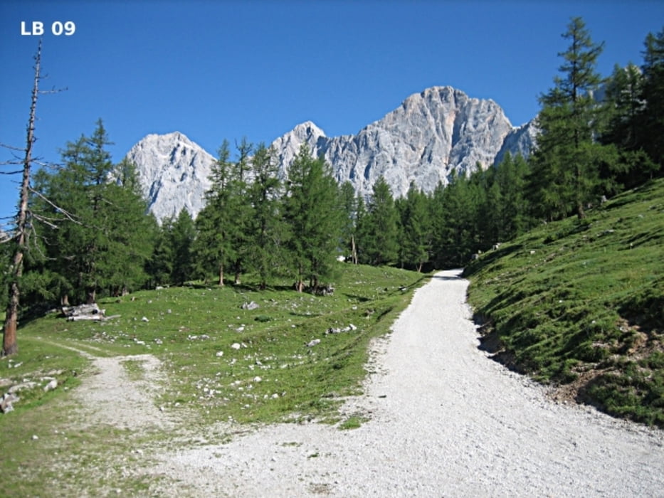
Die MTB - Tour in der Dachstein Tauern Region von Schladming über Ramsau am Dachstein bis zur Türlwand am Fuße der Dachstein-Südwand und über Mandling wieder zurück nach Schladming beginnt bei der Talstation der Planai mitten in Schladming. Diese sehr schöne Rundfahrt mit dem Mountainbike ist durchgehend als Panorama Runde 05 sehr gut beschildert.

Weitere Infos, Fotos und Videos zur MTB - Tour Schladming findest du auf

biketours4you.at


Galeria trasy

Mapa trasy i profil wysokości

  • Open Street Map
  • Google
Minimum height 722 m Maximum height 1697 m Widok szczegółowy

More about the tour author

Trek1400d
Member since 2008

Send private message

Komentarze

GPS tracks

Trackpoints
  • GPX / Garmin Map Source (gpx) download
  • TCX / Garmin Training Center® (tcx) download
  • CRS / Garmin Training Center® (crs) download
  • Google Earth (kml) download
  • G7ToWin (g7t) download
  • TTQV (trk) download
  • Overlay (ovl) download
  • Fugawi (txt) download
  • Kompass (DAV) Track (tk) download
  • Karta trasy (pdf) download
  • Original file of the author (gpx) download

More about the tour author

Trek1400d
Member since 2008

Send private message
Share track
Add to my favorites
Remove from my favorites
Edit tags
My score
Rate
Trasa: MTB Tour Schladming
Rodzaj: Rower górski (MTB)
Długość: 54,0 km
Evaluated on:
Czas trwania:
Day(s)
Hour(s)
Minute(s)
Ocena: Krajobraz Czynnik zadowolenia Kondycja Technika