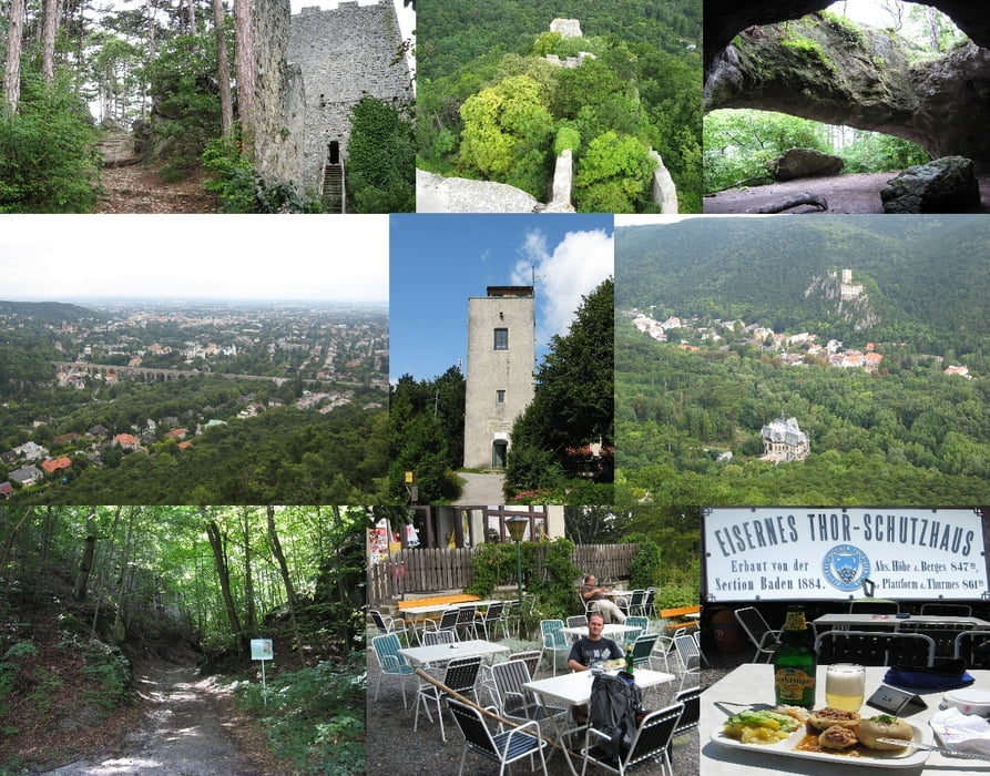
Start ist in Baden, Weilburgstraße. Gekennzeichneter Weg zur Runine Rauheneck (15 Minuten). Sehenswerte kleine Ruine mit beghebaren Burgfried. Sehr schöne Rundumsicht.
Weiter zur Königshöhle über weichen Waldwanderweg.
Weiter Richtung Jägerhaus (Zufahrtmöglichkeit für Auto). Aufstieg zum Schutzhaus "Eisernes Tor" zum Teil über Route 404. Waldwanderweg, Treppelpfade und Holwege. Felsiger Untergrund und Wurzeln.
Schutzhaus "Eisernes Tor" (Montag Ruhetag) mit Aussichtswarte.
Abstieg Richtung Baden über gleichen Weg, jedoch nicht über die Ruine, sondern links vorbei (Route 404) und retour auf Straße zum Parkplatz.
Mapa trasy i profil wysokości
Komentarze
GPS tracks
Trackpoints-
GPX / Garmin Map Source (gpx) download
-
TCX / Garmin Training Center® (tcx) download
-
CRS / Garmin Training Center® (crs) download
-
Google Earth (kml) download
-
G7ToWin (g7t) download
-
TTQV (trk) download
-
Overlay (ovl) download
-
Fugawi (txt) download
-
Kompass (DAV) Track (tk) download
-
Karta trasy (pdf) download
-
Original file of the author (gpx) download


Forstarbeiten