
 Marc Sauer")

Die von uns gefahrenen Touren sind bis auf die Prags Extreme Tour, Tourvorschläge aus der Fun Bike Kartensammlung 09, welche man unter
www.bikearena.it für 10€ inkl. Versand nach Deutschland bestellen kann. Die Karten haben wir zufällig entdeckt und waren ausgesprochen positiv überrascht! Wer die hat braucht eigentlich kein GPS mehr.
Fun Bike Karte 09 Tour 2:
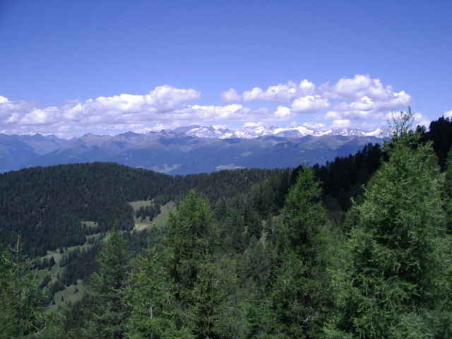
Auf- und Abfahrt durch den Wald. Die Abfahrt am Hang bietet mit Blick auf San Vigilio schöne Eindrücke. Gute Einführungsrunde für den ersten Tag. Kurz, mit knackigen Anstiegen und entspannten Abfahrten. Fliegen ohne Ende.
www.bikearena.it für 10€ inkl. Versand nach Deutschland bestellen kann. Die Karten haben wir zufällig entdeckt und waren ausgesprochen positiv überrascht! Wer die hat braucht eigentlich kein GPS mehr.
Fun Bike Karte 09 Tour 2:
Auf- und Abfahrt durch den Wald. Die Abfahrt am Hang bietet mit Blick auf San Vigilio schöne Eindrücke. Gute Einführungsrunde für den ersten Tag. Kurz, mit knackigen Anstiegen und entspannten Abfahrten. Fliegen ohne Ende.
Further information at
http://www.bikearena.itGaleria trasy
Mapa trasy i profil wysokości
Minimum height 1221 m
Maximum height 1833 m
More about the tour author

|
Komentarze

Startpunkt ist der Marktplatz von San Vigilio oder unser Hotel http://www.carmen.it
GPS tracks
Trackpoints-
GPX / Garmin Map Source (gpx) download
-
TCX / Garmin Training Center® (tcx) download
-
CRS / Garmin Training Center® (crs) download
-
Google Earth (kml) download
-
G7ToWin (g7t) download
-
TTQV (trk) download
-
Overlay (ovl) download
-
Fugawi (txt) download
-
Kompass (DAV) Track (tk) download
-
Karta trasy (pdf) download
-
Original file of the author (gpx) download
More about the tour author
|
|
Add to my favorites
Remove from my favorites
Edit tags
Open track
My score
Rate