Login

Zapomniałeś swój login?

Cookies have to be accepted!
Your browser's cookie functionality is disabled. Please enable this functionality.

Not a member yet?

Register now
Login

Available for registred users only

Log in to use this feature.

Zapomniałeś swój login?

Cookies have to be accepted!
Your browser's cookie functionality is disabled. Please enable this functionality.

Not a member yet?

Register now
Filter
Kategorie
Advanced filters
  • Długość (km)
  • Wysokość
Zapisz filtr Reset filter

TrackRank

QRCode

Technical data

Długość9,3 km Wysokość1100 m Way down1080 m Czas trwania04:30 h:m Data20.09.2009
Oceny Author User Krajobraz Czynnik zadowolenia Kondycja Technika

Statystyka

1338 Widoki 1 Ocena 197 Downloads / Pliki do pobrania 5.00 Przeciętnie
Rate
  • Karta trasy
  • Dojazd
  • Downloads / Pliki do pobrania

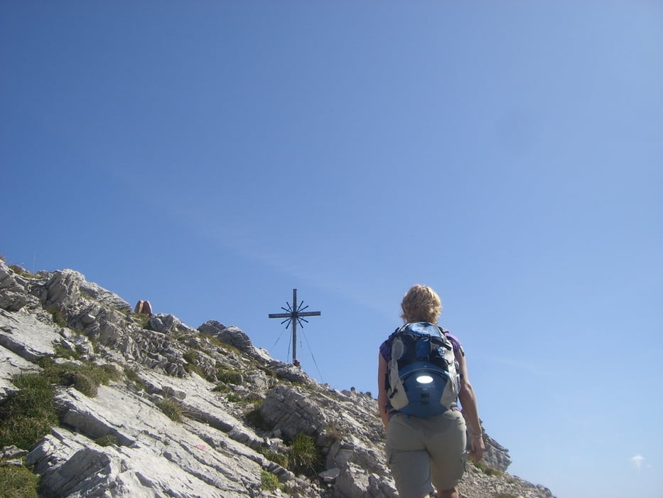
Schöner Aufstieg vom Vilsalpsee über die ober Roßalpe zum Gaißhorn.

Die letzen 300Hm wirds technisch etwas anspruchsvoller, so das ab und zu auch die Hände zu Hilfe genommen werden müssen.

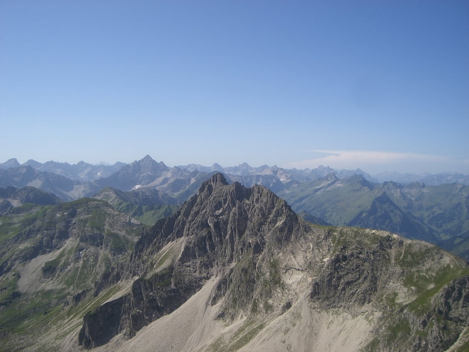
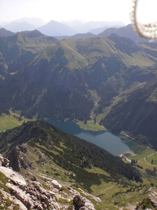
Oben wird man aber mit einem brutalen Panorama belohnt!!!!

Further information at

http://www.gipfelkreuz.eu/58,0,geisshorn-2249-m,index,0.html

Galeria trasy

Mapa trasy i profil wysokości

  • Open Street Map
  • Google
Minimum height 1156 m Maximum height 2248 m Widok szczegółowy

More about the tour author

Blatterter
Member since 2009

Send private message

Komentarze

ChristoHutschel on 03.01.2016

Video zur Tour

Herbstliche Roundtour vom Vilsalpsee über Vilsalpe zur vorderen Schafwanne. Gipfelrast auf dem Geißhorn (2248 m) mit atemberaubender Aussicht und nordseitiger Abstieg (heikel in geröllreicher Flanke) zur lieblichen oberen Roßalpe und weiter zum märchenhaften Vilsalpsee. 6,5 Std, 1100 Hm. Trittsicherheit im Gipfelbereich empfehlenswert. Hier das Video dazu:
http://youtu.be/IZAyg765tfM

Anfahrt von München aus über Sonthofen, dann richtung Reutte nach Tannheim!

Start am Vilsalpsee.

GPS tracks

Trackpoints
  • GPX / Garmin Map Source (gpx) download
  • TCX / Garmin Training Center® (tcx) download
  • CRS / Garmin Training Center® (crs) download
  • Google Earth (kml) download
  • G7ToWin (g7t) download
  • TTQV (trk) download
  • Overlay (ovl) download
  • Fugawi (txt) download
  • Kompass (DAV) Track (tk) download
  • Karta trasy (pdf) download
  • Original file of the author (gpx) download

More about the tour author

Blatterter
Member since 2009

Send private message
Share track
Add to my favorites
Remove from my favorites
Edit tags
My score
Rate
Trasa: Geißhorn
Rodzaj: Trasy górskie
Długość: 9,3 km
Evaluated on:
Czas trwania:
Day(s)
Hour(s)
Minute(s)
Ocena: Krajobraz Czynnik zadowolenia Kondycja Technika