
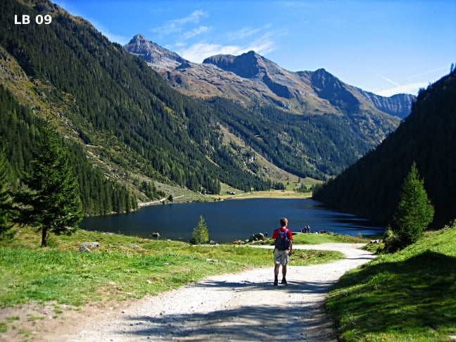

Die Wanderung zum sehr schönen Riesachsee vom Ausgangspunkt Gasthof Riesachfall in Rohrmoos-Untertal ist eine schöne und interessante Familien Wanderung in der Steiermark. Der Riesachfall in der Dachstein Tauern Region ist mit einem Gefälle von 140m (2mal 70m) einer der höchsten Wasserfälle in der Steiermark. Beim Riesachsee gibt es mit der Oberen Gfölleralm und der Kaltenbachalm zwei sehr gute bewirtschaftete Almhütten. Besonders interessant ist der Alpinsteig Höll mit einer 46m langen Seilbrücke.
Weitere Infos und Fotos zur Wandértour Riesachsee findest du auf
biketours4you.at
Mapa trasy i profil wysokości
Minimum height 1065 m
Maximum height 1395 m
More about the tour author
|
|
Trek1400d |
Komentarze

GPS tracks
Trackpoints-
GPX / Garmin Map Source (gpx) download
-
TCX / Garmin Training Center® (tcx) download
-
CRS / Garmin Training Center® (crs) download
-
Google Earth (kml) download
-
G7ToWin (g7t) download
-
TTQV (trk) download
-
Overlay (ovl) download
-
Fugawi (txt) download
-
Kompass (DAV) Track (tk) download
-
Karta trasy (pdf) download
-
Original file of the author (gpx) download
More about the tour author
|
|
Trek1400d |
Add to my favorites
Remove from my favorites
Edit tags
Open track
My score
Rate