


eine leichte Wanderung durch den alten Kern der kleinen Stadt Steinfurt, entland des Wasserschloß Bentheim und durch den Stadtpark Bagno, welcher interessante Sportaktivitäten und Parkanlagen anbietet, sogar für die Kultur.
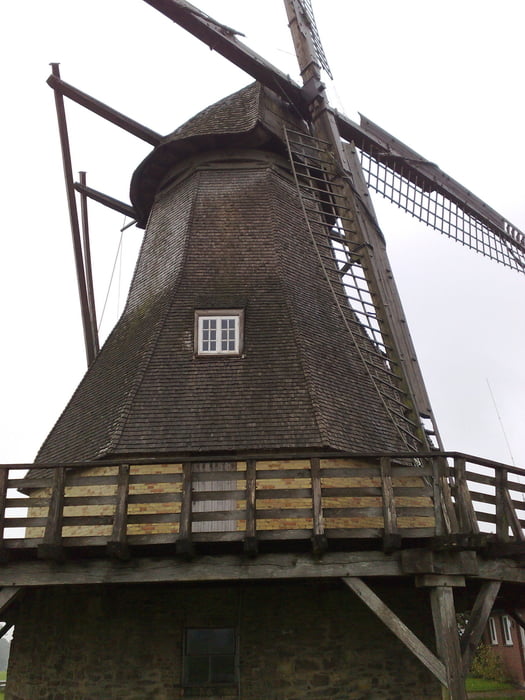
Unterwegs befindet sich die Windmühle Holicher Mühle. Sie wird von einem Verein betrieben und in gutem Zustand behalten. Es lohnt sich diese Windmühle zu besichtigen, bessonders für Kinder.
Unterwegs findet man kein Gasthaus und in Steinfurt ist die Gastronomie begrenzt; daher sollen Sie was zum Essen im Rücksack einpacken !!
Galeria trasy


Mapa trasy i profil wysokości
Minimum height 99999 m
Maximum height -99999 m
More about the tour author

|
alonso100 |
Komentarze

Per Bahn bis Bahnhof Steinfurt-Burgsteinfurt oder Busliniens 175 und R73.
GPS tracks
Trackpoints-
GPX / Garmin Map Source (gpx) download
-
TCX / Garmin Training Center® (tcx) download
-
CRS / Garmin Training Center® (crs) download
-
Google Earth (kml) download
-
G7ToWin (g7t) download
-
TTQV (trk) download
-
Overlay (ovl) download
-
Fugawi (txt) download
-
Kompass (DAV) Track (tk) download
-
Karta trasy (pdf) download
-
Original file of the author (gpx) download
More about the tour author
|
|
alonso100 |
Add to my favorites
Remove from my favorites
Edit tags
Open track
My score
Rate