Login

Zapomniałeś swój login?

Cookies have to be accepted!
Your browser's cookie functionality is disabled. Please enable this functionality.

Not a member yet?

Register now
Login

Available for registred users only

Log in to use this feature.

Zapomniałeś swój login?

Cookies have to be accepted!
Your browser's cookie functionality is disabled. Please enable this functionality.

Not a member yet?

Register now
Filter
Kategorie
Advanced filters
  • Długość (km)
  • Wysokość
Zapisz filtr Reset filter

TrackRank

QRCode

Technical data

Długość30,9 km Wysokość1883 m Way down1890 m Czas trwania02:00 h:m Data19.10.2009
Oceny Author Krajobraz Czynnik zadowolenia Kondycja Technika

Statystyka

300 Widoki Oceny 47 Downloads / Pliki do pobrania Przeciętnie
Rate
  • Karta trasy
  • Dojazd
  • Downloads / Pliki do pobrania

Sonntag Morgen, noch 2 Stunden bis zum Mittagessen,

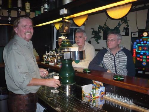
Wir wissen nicht was diese netten Herren am Tresen empfehlen, ich rate zum biken.

Die Tour beginnt In Goldkronach, führt über den Stadtwald hoch nach Hirschhorn dann hinab ins Maintal zur Glasermühle. Von dort hoch über Güßhügel - Schweinsbach - Metzlersreuth hinab zur Entenmühle im Ölschnitztal. Dann weiter über Bad Berneck wieder nach Goldkronach.

Viel Spass!

Mapa trasy i profil wysokości

  • Open Street Map
  • Google
Minimum height 348 m Maximum height 823 m Widok szczegółowy

More about the tour author

berndhuber
Member since 2008

Send private message

Komentarze

huberghr on 21.10.2009

Höhenmeter???

DAs sollen wirklich 1883 hm sein??? Kann ich mir nicht wirklich vorstellen.

GPS tracks

Trackpoints
  • GPX / Garmin Map Source (gpx) download
  • TCX / Garmin Training Center® (tcx) download
  • CRS / Garmin Training Center® (crs) download
  • Google Earth (kml) download
  • G7ToWin (g7t) download
  • TTQV (trk) download
  • Overlay (ovl) download
  • Fugawi (txt) download
  • Kompass (DAV) Track (tk) download
  • Karta trasy (pdf) download
  • Original file of the author (gpx) download

More about the tour author

berndhuber
Member since 2008

Send private message
Share track
Add to my favorites
Remove from my favorites
Edit tags
My score
Rate
Trasa: Sonntag Morgen
Rodzaj: Rower górski (MTB)
Długość: 30,9 km
Evaluated on:
Czas trwania:
Day(s)
Hour(s)
Minute(s)
Ocena: Krajobraz Czynnik zadowolenia Kondycja Technika