Login

Zapomniałeś swój login?

Cookies have to be accepted!
Your browser's cookie functionality is disabled. Please enable this functionality.

Not a member yet?

Register now
Login

Available for registred users only

Log in to use this feature.

Zapomniałeś swój login?

Cookies have to be accepted!
Your browser's cookie functionality is disabled. Please enable this functionality.

Not a member yet?

Register now
Filter
Kategorie
Advanced filters
  • Długość (km)
  • Wysokość
Zapisz filtr Reset filter

TrackRank

QRCode

Technical data

Długość29,8 km Wysokość623 m Way down593 m Czas trwania00:00 h:m Data17.08.2006
Oceny Author User Krajobraz Czynnik zadowolenia Kondycja Technika

Statystyka

2686 Widoki 2 Oceny 660 Downloads / Pliki do pobrania 4.50 Przeciętnie
Rate
  • Karta trasy
  • Dojazd
  • Downloads / Pliki do pobrania
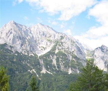
Von Mittenwald über Lauter- und Ferchensee auf den Hohen Kranzberg. Steile Abfahrt und Querung zum Lautersee. Zurückrollen auf Anfahrtsweg nach Mittenwald.

Mapa trasy i profil wysokości

  • Open Street Map
  • Google
Minimum height 582 m Maximum height 1380 m Widok szczegółowy

More about the tour author

klinker

Komentarze

Garmisch -> Mittenwald. Startplatz ist kurz vor Mittenwald am Campingplatz neben der Bundesstraße.

GPS tracks

Trackpoints
  • GPX / Garmin Map Source (gpx) download
  • TCX / Garmin Training Center® (tcx) download
  • CRS / Garmin Training Center® (crs) download
  • Google Earth (kml) download
  • G7ToWin (g7t) download
  • TTQV (trk) download
  • Overlay (ovl) download
  • Fugawi (txt) download
  • Kompass (DAV) Track (tk) download
  • Karta trasy (pdf) download
  • Original file of the author (gpx) download

More about the tour author

klinker

Share track
Add to my favorites
Remove from my favorites
Edit tags
My score
Rate
Trasa: Von Mittenwald zum Hohen Kranzberg
Rodzaj: Rower górski (MTB)
Długość: 29,8 km
Evaluated on:
Czas trwania:
Day(s)
Hour(s)
Minute(s)
Ocena: Krajobraz Czynnik zadowolenia Kondycja Technika