Kleine Rundtour durch den Schönbuch und zurück über Ammerbuch. Wenn man in Kayh startet erreicht man nach ca. 20km das Schloss Hohenentringen mit einer wunderbaren Aussicht und einen schönen Biergarten. Es kann hier gut gegessen, gevespert oder einfach nur getrunken werden. Kaffee und Kuchen gibt es natürlich auch. Je nach Uhrzeit und Laune.
Further information at
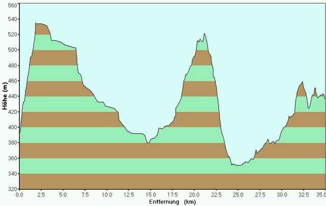
http://www.hohenentringen.de/Mapa trasy i profil wysokości
Minimum height 350 m
Maximum height 536 m
Komentarze

GPS tracks
Trackpoints-
GPX / Garmin Map Source (gpx) download
-
TCX / Garmin Training Center® (tcx) download
-
CRS / Garmin Training Center® (crs) download
-
Google Earth (kml) download
-
G7ToWin (g7t) download
-
TTQV (trk) download
-
Overlay (ovl) download
-
Fugawi (txt) download
-
Kompass (DAV) Track (tk) download
-
Karta trasy (pdf) download
-
Original file of the author (g7t) download
Add to my favorites
Remove from my favorites
Edit tags
Open track
My score
Rate


