Login

Zapomniałeś swój login?

Cookies have to be accepted!
Your browser's cookie functionality is disabled. Please enable this functionality.

Not a member yet?

Register now
Login

Available for registred users only

Log in to use this feature.

Zapomniałeś swój login?

Cookies have to be accepted!
Your browser's cookie functionality is disabled. Please enable this functionality.

Not a member yet?

Register now
Filter
Kategorie
Advanced filters
  • Długość (km)
  • Wysokość
Zapisz filtr Reset filter

TrackRank

QRCode

Technical data

Długość11,8 km Wysokość183 m Way down1292 m Czas trwania04:00 h:m Data07.12.2009
Oceny Author Krajobraz Czynnik zadowolenia Kondycja Technika

Statystyka

705 Widoki 2 Oceny 115 Downloads / Pliki do pobrania 4.50 Przeciętnie
Rate
  • Karta trasy
  • Dojazd
  • Downloads / Pliki do pobrania

Am Anfang etwas mühsam ( lange schiebestrecken).

Vom Wald heraussen wird man mit einer grandiosen Landschaft belohnt.

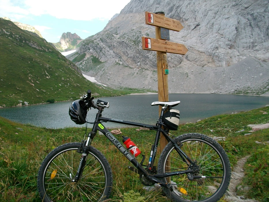
Der See ist die Perle dieser Region

Galeria trasy

Mapa trasy i profil wysokości

  • Open Street Map
  • Google
Minimum height 994 m Maximum height 2185 m Widok szczegółowy

More about the tour author

haertl
Member since 2008

Send private message

Komentarze

Julian0o on 17.08.2011

Oh ja!

Der Wolayersee ist einer der schönsten Seen der Welt. Nicht umsonst haben die Einheimischen dem See ein eigenes Lied gewidmet. Das Wolayersee Lied. Und Wenn es dann noch vom Gemischten Liesinger Chor am Wolayersee gesungen wird, ein Traum. Das Echo in den Bergen...wunderschön.

Ich bin dort aufgewachsen und kann sagen das es auf jeden Fall ein Ausritt oder eine Wanderung wert ist!

Ich liebe den See!

Von Kötschach im Gailtal nach Birnbaum.

Nach Birnbaum Links.

Vom "Einstieg" kann man mit dem Auto noch bis zu einer Kapelle fahren und dort parken.

GPS tracks

Trackpoints
  • GPX / Garmin Map Source (gpx) download
  • TCX / Garmin Training Center® (tcx) download
  • CRS / Garmin Training Center® (crs) download
  • Google Earth (kml) download
  • G7ToWin (g7t) download
  • TTQV (trk) download
  • Overlay (ovl) download
  • Fugawi (txt) download
  • Kompass (DAV) Track (tk) download
  • Karta trasy (pdf) download
  • Original file of the author (gpx) download

More about the tour author

haertl
Member since 2008

Send private message
Share track
Add to my favorites
Remove from my favorites
Edit tags
My score
Rate
Trasa: Wolayer See
Rodzaj: Rower górski (MTB)
Długość: 11,8 km
Evaluated on:
Czas trwania:
Day(s)
Hour(s)
Minute(s)
Ocena: Krajobraz Czynnik zadowolenia Kondycja Technika