


Tour in Anlehnung an die Provence-Tour Nr. 3 aus Mountainbike-Magazin.
Apt - Jean-Jean - Trécassats - Trou des Américains - Rustrel - Barriès - La Croix de Christol - Les Blaces.
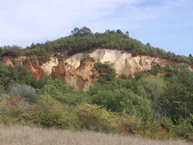
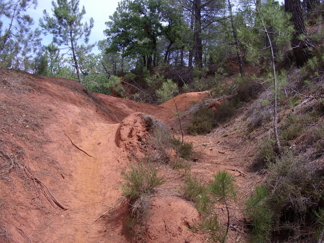
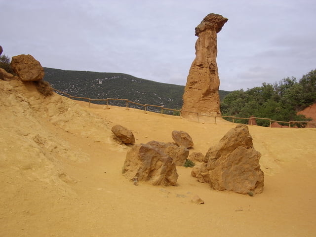
Landschaftlich schöne Nachmittagstour, mit einigen Singletrails.
Strecke führt größtenteils an gut markierten Wanderwegen (gelbe Markierung) entlang.
Apt - Jean-Jean - Trécassats - Trou des Américains - Rustrel - Barriès - La Croix de Christol - Les Blaces.
Landschaftlich schöne Nachmittagstour, mit einigen Singletrails.
Strecke führt größtenteils an gut markierten Wanderwegen (gelbe Markierung) entlang.
Further information at
http://www.luberon-apt.frGaleria trasy
Mapa trasy i profil wysokości
Minimum height 191 m
Maximum height 576 m
More about the tour author

|
Komentarze

Einstieg der Tour ist Apt. Ca. 70 km nördlich von Marseille.
GPS tracks
Trackpoints-
GPX / Garmin Map Source (gpx) download
-
TCX / Garmin Training Center® (tcx) download
-
CRS / Garmin Training Center® (crs) download
-
Google Earth (kml) download
-
G7ToWin (g7t) download
-
TTQV (trk) download
-
Overlay (ovl) download
-
Fugawi (txt) download
-
Kompass (DAV) Track (tk) download
-
Karta trasy (pdf) download
-
Original file of the author (gpx) download
More about the tour author
|
|
Add to my favorites
Remove from my favorites
Edit tags
Open track
My score
Rate