Login

Zapomniałeś swój login?

Cookies have to be accepted!
Your browser's cookie functionality is disabled. Please enable this functionality.

Not a member yet?

Register now
Login

Available for registred users only

Log in to use this feature.

Zapomniałeś swój login?

Cookies have to be accepted!
Your browser's cookie functionality is disabled. Please enable this functionality.

Not a member yet?

Register now
Filter
Kategorie
Advanced filters
  • Długość (km)
  • Wysokość
Zapisz filtr Reset filter

TrackRank

QRCode

Technical data

Długość20,7 km Wysokość1785 m Way down857 m Czas trwania00:00 h:m Data01.03.2010
Oceny Author Krajobraz Czynnik zadowolenia Kondycja Technika

Statystyka

1901 Widoki Oceny 99 Downloads / Pliki do pobrania Przeciętnie
Rate
  • Karta trasy
  • Dojazd
  • Downloads / Pliki do pobrania

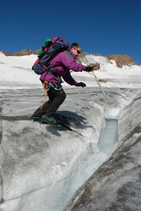
Sehr schöne Hochtour.


wir sind am Freitag nach der Arbeit angereist, haben ein paar Stunden am Bach, unterhalb der Hütte biwakiert, sind noch in der Dunkelheit aufgebrochen und auf die Hochvernagtspitze.
Für Konditionsstarke ist das eine ideale Möglichkeit!

Mittags waren wir wieder unten.

Es besteht natürlich auch die Möglichkeit durchzugehen oder auf der Hütte zu übernachten.

Galeria trasy

Mapa trasy i profil wysokości

  • Open Street Map
  • Google
Minimum height 1843 m Maximum height 3533 m Widok szczegółowy

More about the tour author

Helhesten
Member since 2009

Send private message

Komentarze

Ausgangspunkt ist Vent

GPS tracks

Trackpoints
  • GPX / Garmin Map Source (gpx) download
  • TCX / Garmin Training Center® (tcx) download
  • CRS / Garmin Training Center® (crs) download
  • Google Earth (kml) download
  • G7ToWin (g7t) download
  • TTQV (trk) download
  • Overlay (ovl) download
  • Fugawi (txt) download
  • Kompass (DAV) Track (tk) download
  • Karta trasy (pdf) download
  • Original file of the author (gpx) download

More about the tour author

Helhesten
Member since 2009

Send private message
Share track
Add to my favorites
Remove from my favorites
Edit tags
My score
Rate
Trasa: Hochvernagtspitze
Rodzaj: Trasy górskie
Długość: 20,7 km
Evaluated on:
Czas trwania:
Day(s)
Hour(s)
Minute(s)
Ocena: Krajobraz Czynnik zadowolenia Kondycja Technika