

Wer hat nicht schon von der einmaligen Schönheit der Ardèche-Schluchten gehört oder davon geträumt, durch diese herrliche Landschaft zu wandern?
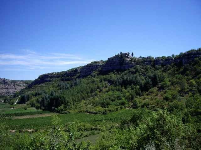
Start: Parking de Lestong. Wanderung Sie oberhalb der steilen (nichts für unachtsame Kinder) Felswandschluchten des Chassezac und durch den beeindruckenden Steinwald (le bois de Païolive).
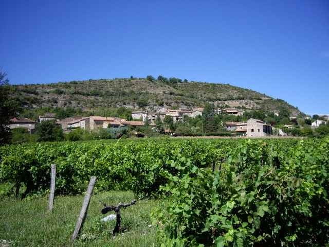
Lassen Sie sich verzaubern von dem einzigartigen Flair der Umgebung und wandern Sie ins Tal des Chassezac, durch das kleine Dorf Chassagnes umgeben von Weinfeldern.
Teilweise wandern Sie auf steinigen Pfaden, festes Schuhwerk empfohlen.
Weiterführender Link auf Französisch
Start: Parking de Lestong. Wanderung Sie oberhalb der steilen (nichts für unachtsame Kinder) Felswandschluchten des Chassezac und durch den beeindruckenden Steinwald (le bois de Païolive).
Lassen Sie sich verzaubern von dem einzigartigen Flair der Umgebung und wandern Sie ins Tal des Chassezac, durch das kleine Dorf Chassagnes umgeben von Weinfeldern.
Teilweise wandern Sie auf steinigen Pfaden, festes Schuhwerk empfohlen.
Weiterführender Link auf Französisch
Further information at
http://www.chez.com/lieuxinsolites/ardeche/paiolive/paiolive.phpGaleria trasy
Mapa trasy i profil wysokości
Minimum height 128 m
Maximum height 253 m
More about the tour author

|
christiankrier |
Komentarze

GPS tracks
Trackpoints-
GPX / Garmin Map Source (gpx) download
-
TCX / Garmin Training Center® (tcx) download
-
CRS / Garmin Training Center® (crs) download
-
Google Earth (kml) download
-
G7ToWin (g7t) download
-
TTQV (trk) download
-
Overlay (ovl) download
-
Fugawi (txt) download
-
Kompass (DAV) Track (tk) download
-
Karta trasy (pdf) download
-
Original file of the author (gpx) download
More about the tour author
|
|
christiankrier |
Add to my favorites
Remove from my favorites
Edit tags
Open track
My score
Rate