Login

Zapomniałeś swój login?

Cookies have to be accepted!
Your browser's cookie functionality is disabled. Please enable this functionality.

Not a member yet?

Register now
Login

Available for registred users only

Log in to use this feature.

Zapomniałeś swój login?

Cookies have to be accepted!
Your browser's cookie functionality is disabled. Please enable this functionality.

Not a member yet?

Register now
Filter
Kategorie
Advanced filters
  • Długość (km)
  • Wysokość
Zapisz filtr Reset filter

TrackRank

QRCode

Technical data

Długość30,5 km Wysokość738 m Way down757 m Czas trwania02:30 h:m Data06.06.2010
Oceny Author Krajobraz Czynnik zadowolenia Kondycja Technika

Statystyka

1163 Widoki Oceny 346 Downloads / Pliki do pobrania Przeciętnie
Rate
  • Karta trasy
  • Dojazd
  • Downloads / Pliki do pobrania

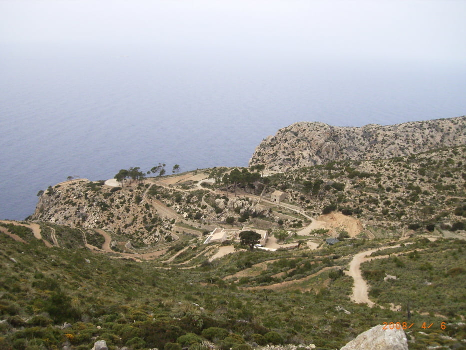
Vom Ortsausgang Pequera die Straße nach Andrax und dann weiter Richtung Sant Elm. Der Spaß beginnt langsam, wenn wir endlich den Asphalt hinter uns lassen. Den zum Schluß sehr steilen Anstieg kann man noch toppen, wenn bis zum Kloster heruntergefahren wird...

Herrliche Aussichten, der Puls nach oben offen und der Kitzel der Abfahrt ergeben einen hohen Spaßfaktor.

Der Weg zurück erfolgt auf Nebenstraßen.

Galeria trasy

Mapa trasy i profil wysokości

  • Open Street Map
  • Google
Minimum height -5 m Maximum height 365 m Widok szczegółowy

More about the tour author

mtbrenner
Member since 2010

Send private message

Komentarze

GPS tracks

Trackpoints
  • GPX / Garmin Map Source (gpx) download
  • TCX / Garmin Training Center® (tcx) download
  • CRS / Garmin Training Center® (crs) download
  • Google Earth (kml) download
  • G7ToWin (g7t) download
  • TTQV (trk) download
  • Overlay (ovl) download
  • Fugawi (txt) download
  • Kompass (DAV) Track (tk) download
  • Karta trasy (pdf) download
  • Original file of the author (gpx) download

More about the tour author

mtbrenner
Member since 2010

Send private message
Share track
Add to my favorites
Remove from my favorites
Edit tags
My score
Rate
Trasa: Pequera nach La Trappa
Rodzaj: Rower górski (MTB)
Długość: 30,5 km
Evaluated on:
Czas trwania:
Day(s)
Hour(s)
Minute(s)
Ocena: Krajobraz Czynnik zadowolenia Kondycja Technika