
")

Extremtour, gefunden von Christoph bei Bikehausen.ch
Hat mir bis auf den sehr schwierigen Abstieg vom Binnelgrat sehr gut gefallen.
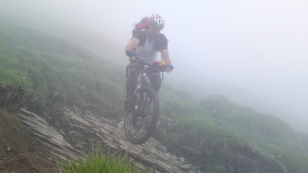
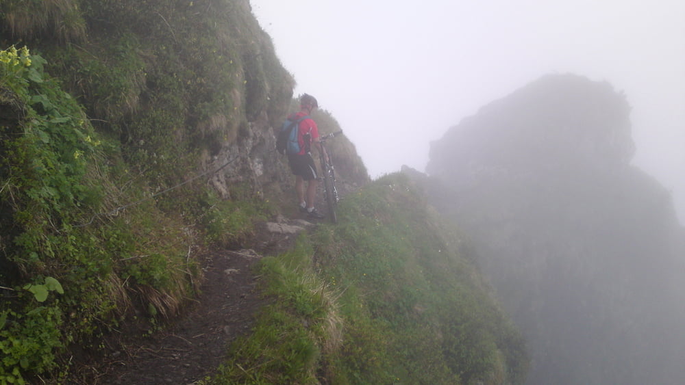
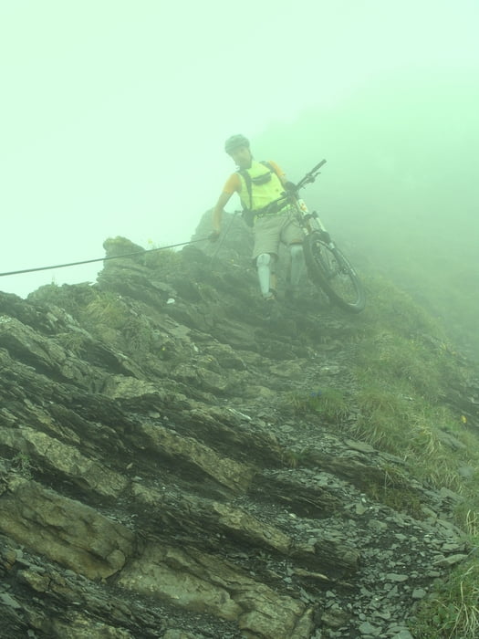
Den Binnelgratabstieg (alpiner Steig) ist nur am späten Nachmittag oder bei schlechter Sicht sinnvoll - wenn die Wanderer weg sind. An rutschfeste Schuhe denken. Das Rad kann 2x alleine kaum über die Seilpassagen gehoben werden (oder diese Passagen Rad zur Sicherheit abseilen).
Die ersten Passagen nach dem Binnelgratabstieg sind extrem schwer und mit Absturzgefahr behaftet, es wird dann schnell etwas leichter. Die Abfahrt vom Alpkopf ist klasse, wer das Gelände kennt, kann sich kaum vorstellen, daß der Weg so gut fahrbar ist.
Galeria trasy
Mapa trasy i profil wysokości
Minimum height 413 m
Maximum height 2004 m
More about the tour author
|
|
skyhopper |
Komentarze

Start in Röthis, Weiler, Hohenems oder Dornbirn.
GPS tracks
Trackpoints-
GPX / Garmin Map Source (gpx) download
-
TCX / Garmin Training Center® (tcx) download
-
CRS / Garmin Training Center® (crs) download
-
Google Earth (kml) download
-
G7ToWin (g7t) download
-
TTQV (trk) download
-
Overlay (ovl) download
-
Fugawi (txt) download
-
Kompass (DAV) Track (tk) download
-
Karta trasy (pdf) download
-
Original file of the author (gpx) download
More about the tour author
|
|
skyhopper |
Add to my favorites
Remove from my favorites
Edit tags
Open track
My score
Rate