

Schöne Feierabendrunde zum austoben. Die Strecke hat alles dabei, Feldwege durch Wiesen, Forstwege, geteerte Straßen (nur wo´s nicht anders ging), paar Meter Morast (ist aber nicht schlimm, wenn man nicht empfindlich ist), Waldtrails, und wunderschöne Ausblicke.
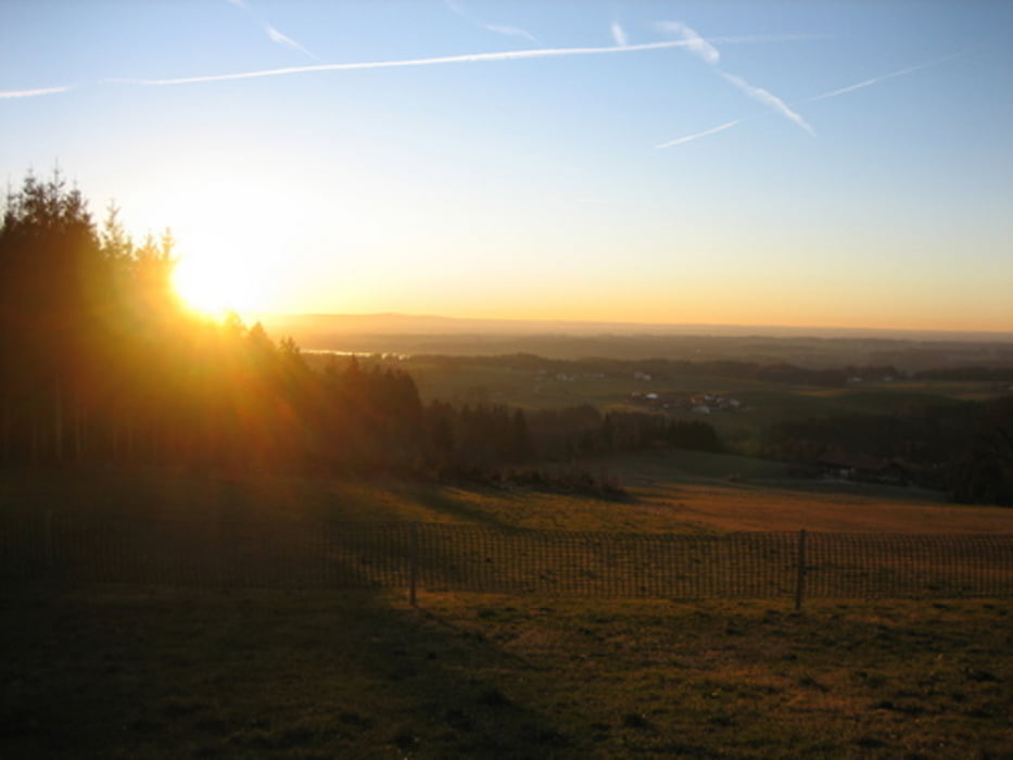
Die Tour beginnt in Antwort (Nähe Kirche) und führt erstmal eben durch´s Moos, schön zum einradeln. Entlang an Thalkirchener Achen, dann erstmal steil (geteert) bergauf. Dann ist es permanent abwechslungsreich, es gibt eigentlich keine Strecke die mal fad wird, weil sie sich zu lange hinzieht. Als Schmankerl (und die Mühe lohnt sich!) geht es gegen Ende noch mal ordentlich über die Ratzinger Höhe mit super Aussichten.
Zum Ende der Tour wird man mit netten Waldtrails belohnt und es geht bis zum Ausgangspunkt nur noch bergab.
Sonstige Infos:
15m Schiebestrecke bei km13,6. Etwa 200m verkommener Waldweg bei km17,4 (ist aber fahrbar)
Mapa trasy i profil wysokości
Minimum height 475 m
Maximum height 688 m
More about the tour author
|
|
liphan |
Komentarze

GPS tracks
Trackpoints-
GPX / Garmin Map Source (gpx) download
-
TCX / Garmin Training Center® (tcx) download
-
CRS / Garmin Training Center® (crs) download
-
Google Earth (kml) download
-
G7ToWin (g7t) download
-
TTQV (trk) download
-
Overlay (ovl) download
-
Fugawi (txt) download
-
Kompass (DAV) Track (tk) download
-
Karta trasy (pdf) download
-
Original file of the author (gpx) download
More about the tour author
|
|
liphan |
Add to my favorites
Remove from my favorites
Edit tags
Open track
My score
Rate