


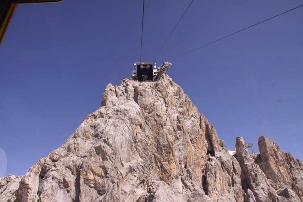
Der Steig gehört zu den schwersten Klettersteigen der Ostalpen. Bei einer Begehung ist eine gehörige Portion Mut und Armkraft gefragt. Der Zustieg ist bei dieser Tour über Talstation Türlwand u. Südwandhütte.
Der deutlich leichtere Einstieg wäre von der Bergstation hinunter zur Hunerscharte. Den Hunerschartensteig entlang bis zur Abzweigung "Sky Walk"
Die Maut und die Dachsteinbahn ist mit der Sommercard gratis. Sommercard bei Übernachtung im Hotel Annelies inkludiert.
Further information at
http://www.hotel-annelies.atGaleria trasy
Mapa trasy i profil wysokości
Minimum height 1683 m
Maximum height 2686 m
More about the tour author
|
|
Hotel_Annelies |
Komentarze

Von Hotel Annelies/Kulm bis zur Mautstraße Dachstein u. Talstation. Die Maut und die Dachsteinbahn ist mit der Sommercard gratis. Sommercard bei Übernachtung im Hotel Annelies inkludiert.
GPS tracks
Trackpoints-
GPX / Garmin Map Source (gpx) download
-
TCX / Garmin Training Center® (tcx) download
-
CRS / Garmin Training Center® (crs) download
-
Google Earth (kml) download
-
G7ToWin (g7t) download
-
TTQV (trk) download
-
Overlay (ovl) download
-
Fugawi (txt) download
-
Kompass (DAV) Track (tk) download
-
Karta trasy (pdf) download
-
Original file of the author (gpx) download
More about the tour author
|
|
Hotel_Annelies |
Add to my favorites
Remove from my favorites
Edit tags
Open track
My score
Rate