
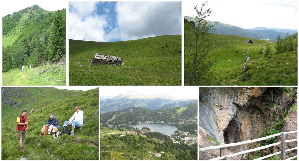

Start ist beim Nocky-Flitzer auf der Turracher Höhe. Dann geht es der sehr guten Beschilderung folgend den Barbara Weg entlang.
Zuerst steigt man durch den Wald zum Lawinenverbau auf und kommt anschließend in ein langgestrecktes Seitental. Dort trifft man auf das alte Bergwerk und steigt anschließend auf zur Nase des Kornock. Von dort gibt es eine wunderbare Fernsicht auf den Turracher See und die umliegenden Berge.
Der Abstieg führt über die Bergstation des Nocky-Flitzers hinab zur Gletscher-Schmelze und von dort weiter zur Spotzl-Hütten, der Trasse des Lifts und hinab zum Startpunkt.
Mapa trasy i profil wysokości
Minimum height 1720 m
Maximum height 2094 m
More about the tour author
|
|
huberj59 |
Komentarze

B95 bis Turracher Höhe. Parkplatz beim Nocky-Flitzer suchen.
GPS tracks
Trackpoints-
GPX / Garmin Map Source (gpx) download
-
TCX / Garmin Training Center® (tcx) download
-
CRS / Garmin Training Center® (crs) download
-
Google Earth (kml) download
-
G7ToWin (g7t) download
-
TTQV (trk) download
-
Overlay (ovl) download
-
Fugawi (txt) download
-
Kompass (DAV) Track (tk) download
-
Karta trasy (pdf) download
-
Original file of the author (gpx) download
More about the tour author
|
|
huberj59 |
Add to my favorites
Remove from my favorites
Edit tags
Open track
My score
Rate