Login

Zapomniałeś swój login?

Cookies have to be accepted!
Your browser's cookie functionality is disabled. Please enable this functionality.

Not a member yet?

Register now
Login

Available for registred users only

Log in to use this feature.

Zapomniałeś swój login?

Cookies have to be accepted!
Your browser's cookie functionality is disabled. Please enable this functionality.

Not a member yet?

Register now
Filter
Kategorie
Advanced filters
  • Długość (km)
  • Wysokość
Zapisz filtr Reset filter

TrackRank

QRCode

Technical data

Długość122,7 km Wysokość3874 m Way down3874 m Czas trwania05:00 h:m Data20.07.2010
Oceny Author Krajobraz Czynnik zadowolenia Kondycja Technika

Statystyka

1392 Widoki Oceny 40 Downloads / Pliki do pobrania Przeciętnie
Rate
  • Karta trasy
  • Dojazd
  • Downloads / Pliki do pobrania


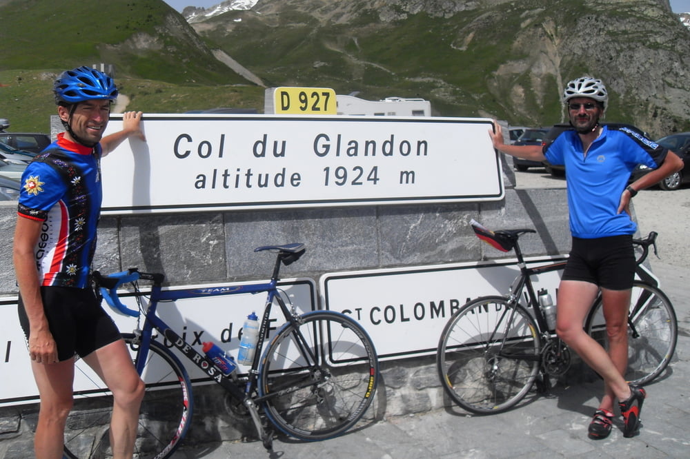
Der Col du Glandon (1924m) und der Col de la Croix de Fer (2067m) liegen ca. 2,5 km auseinander. Sie verbinden Bourg d’Oisans (am Fuße von Alpe d’Huez) im Süden mit La Chambre (Glandon) und St. Jean de Maurienne (Croix de Fer) im nördlich gelegenen Arc-Tal. Beides sind natürlich berühmte und von den Fahrern der Tour de France schon oft angesteuerte Pässe.
Zurück geht es über den parallel gelegenen Col du Mollard, .


Further information at

http://www.rsv-sulzfeld.de

Galeria trasy

Mapa trasy i profil wysokości

  • Open Street Map
  • Google
Minimum height 463 m Maximum height 2072 m Widok szczegółowy

More about the tour author

Stefan68
Member since 2009

Send private message

Komentarze

mit dem Rennrad

GPS tracks

Trackpoints
  • GPX / Garmin Map Source (gpx) download
  • TCX / Garmin Training Center® (tcx) download
  • CRS / Garmin Training Center® (crs) download
  • Google Earth (kml) download
  • G7ToWin (g7t) download
  • TTQV (trk) download
  • Overlay (ovl) download
  • Fugawi (txt) download
  • Kompass (DAV) Track (tk) download
  • Karta trasy (pdf) download
  • Original file of the author (gpx) download

More about the tour author

Stefan68
Member since 2009

Send private message
Share track
Add to my favorites
Remove from my favorites
Edit tags
My score
Rate
Trasa: Modane Bonusrunde
Rodzaj: Rower szosowy
Długość: 122,7 km
Evaluated on:
Czas trwania:
Day(s)
Hour(s)
Minute(s)
Ocena: Krajobraz Czynnik zadowolenia Kondycja Technika