


Aufstieg zum Habicht von Neustift aus über die Elferhütte, via Panoramaweg zur Karalm und weiter zur Innsbrucker Hütte.
Den ersten Aufstieg zur Elferhütte kann man sich weglassen. Zwar ist es was de Aussicht und die Natur angeht empfehlenswert, aber bei dem Vorhaben bis zur Innsbrucker Hütte zu wandern, lässt sich durch eine Fahrt mit der Gondel einiges an Kraft sparen, die man später - das kann ich vorweg nehmen - noch braucht.
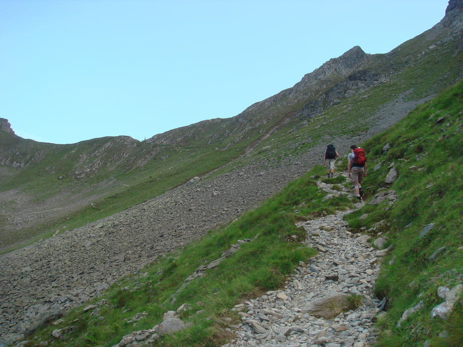
Von der Elferhütte aus sind wir den Panoramaweg Richtung Karalm gegangen. Sehr zu empfehlen: Tolle Aussicht und Rundblicke über die Stubaier Alpen. Allerdings ist der Abstieg zur Karalm relativ heftig und kraftraubend.
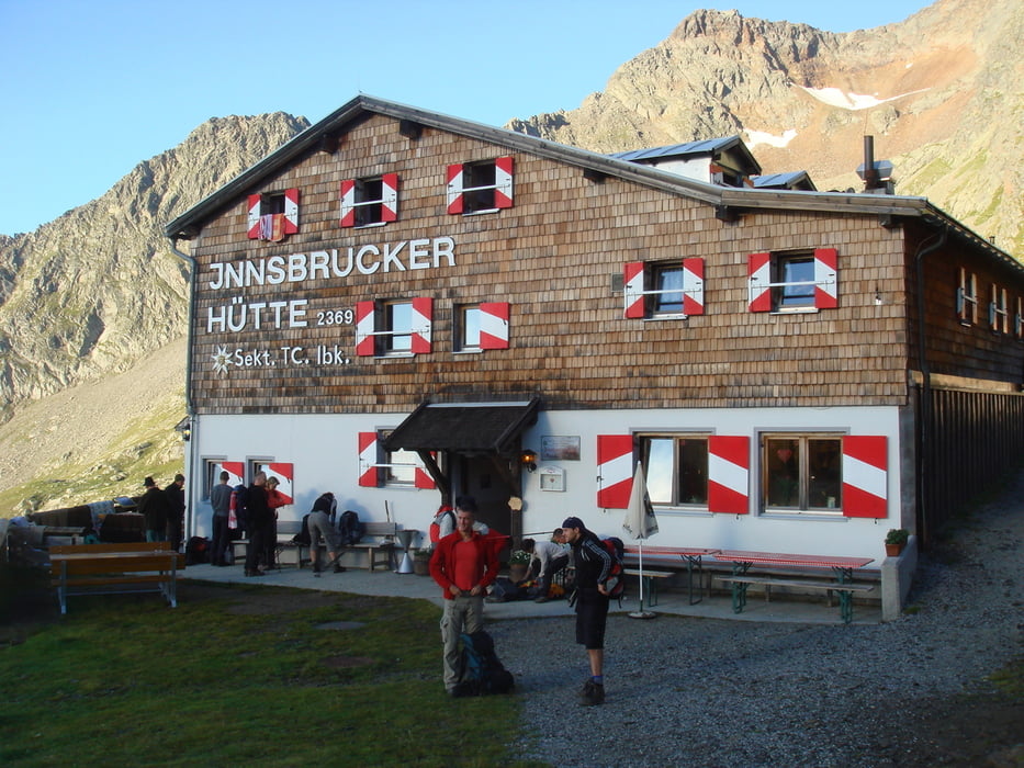
Von der Karalm aus ist es in 1,5 h bis zur Innsbrucker Hütte zu schaffen - bei relativ strammen Schritt. Zu laufen sind die Wege noch recht leicht aber konditionell anspruchsvoll.
Further information at
http://maps.google.de/maps?f=q&source=s_q&hl=de&geocode=&q=neustift+im+stubaital&sll=47.110578,11.306501&sspn=0.55611,1.454315&ie=UTF8&hq=&hnear=Neustift+im+Stubaital,+Innsbruck-Land,+Tirol,+%C3%96sterreich&z=11Galeria trasy
Mapa trasy i profil wysokości
Minimum height 982 m
Maximum height 2372 m
More about the tour author

|
elpadre33 |
Komentarze

Am besten lässt es sich von Neustift aus starten (Nähe Kirche Dorfmitte).
GPS tracks
Trackpoints-
GPX / Garmin Map Source (gpx) download
-
TCX / Garmin Training Center® (tcx) download
-
CRS / Garmin Training Center® (crs) download
-
Google Earth (kml) download
-
G7ToWin (g7t) download
-
TTQV (trk) download
-
Overlay (ovl) download
-
Fugawi (txt) download
-
Kompass (DAV) Track (tk) download
-
Karta trasy (pdf) download
-
Original file of the author (gpx) download
More about the tour author
|
|
elpadre33 |
Add to my favorites
Remove from my favorites
Edit tags
Open track
My score
Rate