Login

Zapomniałeś swój login?

Cookies have to be accepted!
Your browser's cookie functionality is disabled. Please enable this functionality.

Not a member yet?

Register now
Login

Available for registred users only

Log in to use this feature.

Zapomniałeś swój login?

Cookies have to be accepted!
Your browser's cookie functionality is disabled. Please enable this functionality.

Not a member yet?

Register now
Filter
Kategorie
Advanced filters
  • Długość (km)
  • Wysokość
Zapisz filtr Reset filter

TrackRank

QRCode

Technical data

Długość8,9 km Wysokość511 m Way down29 m Czas trwania05:00 h:m Data30.08.2010
Oceny Author Krajobraz Czynnik zadowolenia Kondycja Technika

Statystyka

515 Widoki Oceny 100 Downloads / Pliki do pobrania Przeciętnie
Rate
  • Karta trasy
  • Dojazd
  • Downloads / Pliki do pobrania

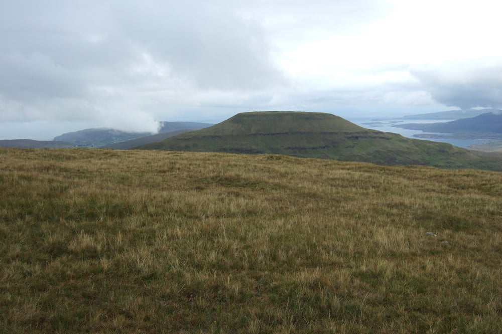
Schöne Wanderung Querfeldein zu dem "höchsten" der beiden Mac Leod's Tabels. 

Gutes Schuhwerk, Wind+Regenjacke und ne Karte sind hilfreich (ohwohl uns die örtliche Karte etwas verwirrt hat, da dort Wald eingezeichnet ist, der mittlerweile abgeholzt ist).

Ansonsten wünsch ich viel Spaß auf der Wanderung!

Hier noch ein kleines Video zur Tour:

https://www.youtube.com/watch?v=fGc0HvF7wEg 


Galeria trasy

Mapa trasy i profil wysokości

  • Open Street Map
  • Google
Minimum height 6 m Maximum height 489 m Widok szczegółowy

More about the tour author

M1530
Member since 2009

Send private message

Komentarze

GPS tracks

Trackpoints
  • GPX / Garmin Map Source (gpx) download
  • TCX / Garmin Training Center® (tcx) download
  • CRS / Garmin Training Center® (crs) download
  • Google Earth (kml) download
  • G7ToWin (g7t) download
  • TTQV (trk) download
  • Overlay (ovl) download
  • Fugawi (txt) download
  • Kompass (DAV) Track (tk) download
  • Karta trasy (pdf) download
  • Original file of the author (gpx) download

More about the tour author

M1530
Member since 2009

Send private message
Share track
Add to my favorites
Remove from my favorites
Edit tags
My score
Rate
Trasa: MacLeod's Tables (18 km)
Rodzaj: Wędrówki
Długość: 8,9 km
Evaluated on:
Czas trwania:
Day(s)
Hour(s)
Minute(s)
Ocena: Krajobraz Czynnik zadowolenia Kondycja Technika