
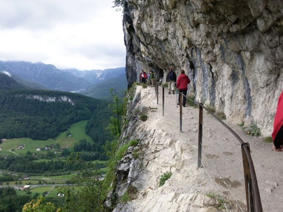

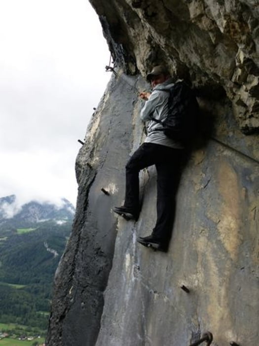
Startpunkt: Rathluckn-Hütte in Wurmstein bei Bad Goisern. Von der Hütte zur Ewigen Wand, durch mehrere Tunnel durch den herausgesprengten, gesicherten Weg durch die Wand. Weiter auf Forstwegen bis zur Abzweigung Rossmoosalm und Predigstuhl. Steil durch den Wald einen Hang hinauf, weiter auf dem Forstweg zur Rossmoosalm. Dann wieder hinunter zum Berggasthof Predigstuhl und auf dem Güterweg zurück zur Rathluckn Hütte
Galeria trasy


Mapa trasy i profil wysokości
Minimum height 731 m
Maximum height 1088 m
More about the tour author
|
|
Fritzl71 |
Komentarze

Gmunden - Bad Ischl - Bad Goisern, am Güterweg bis zur Rathluckn Hütte in Wurmstein
GPS tracks
Trackpoints-
GPX / Garmin Map Source (gpx) download
-
TCX / Garmin Training Center® (tcx) download
-
CRS / Garmin Training Center® (crs) download
-
Google Earth (kml) download
-
G7ToWin (g7t) download
-
TTQV (trk) download
-
Overlay (ovl) download
-
Fugawi (txt) download
-
Kompass (DAV) Track (tk) download
-
Karta trasy (pdf) download
-
Original file of the author (gpx) download
More about the tour author
|
|
Fritzl71 |
Add to my favorites
Remove from my favorites
Edit tags
Open track
My score
Rate