

Schöne Tour oberhalb Cortina d'Ampezzo mit Gondelbahn Zustieg und Godelbahn-Abstieg
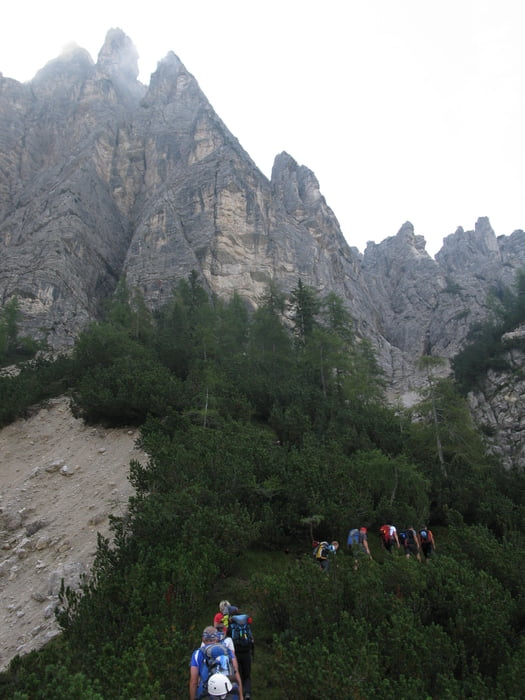
Mit der Gondelbahn Faloria bis zur Mittelstation. Von dort in 45 min. hinauf zum Einstieg auf 1800m. Zuerst etwas erdig die ersten Steilstufen hinauf. Der Fels wird immer griffiger und der gut gesicherte Klettersteig immer steiler. Aber es dürfte bis ganz hinauf keine großen Probleme geben. Der Steig liegt am Vormittag im chatten und man gelangt erst die letzten 100 m in die Sonne.
Vom Ausstieg in nur 5 min. zur Gondelbahn Bergstation und dann zurück hinunter bis ins Tal. Die Gondel fährt alle 30 min (8:30 / 9:00 / 9:30.....) Kosten 18 Euro oder ca. 10 Euro in der Gruppe
Galeria trasy


Mapa trasy i profil wysokości
Minimum height 1511 m
Maximum height 2103 m
More about the tour author
|
|
renrew |
Komentarze

Cortina d'Ampezzo Gondelbahn FALORIA
GPS tracks
Trackpoints-
GPX / Garmin Map Source (gpx) download
-
TCX / Garmin Training Center® (tcx) download
-
CRS / Garmin Training Center® (crs) download
-
Google Earth (kml) download
-
G7ToWin (g7t) download
-
TTQV (trk) download
-
Overlay (ovl) download
-
Fugawi (txt) download
-
Kompass (DAV) Track (tk) download
-
Karta trasy (pdf) download
-
Original file of the author (gpx) download
More about the tour author
|
|
renrew |
Add to my favorites
Remove from my favorites
Edit tags
Open track
My score
Rate