Login

Zapomniałeś swój login?

Cookies have to be accepted!
Your browser's cookie functionality is disabled. Please enable this functionality.

Not a member yet?

Register now
Login

Available for registred users only

Log in to use this feature.

Zapomniałeś swój login?

Cookies have to be accepted!
Your browser's cookie functionality is disabled. Please enable this functionality.

Not a member yet?

Register now
Filter
Kategorie
Advanced filters
  • Długość (km)
  • Wysokość
Zapisz filtr Reset filter

TrackRank

QRCode

Technical data

Długość61,9 km Wysokość1661 m Way down1498 m Czas trwania03:53 h:m Data12.09.2010
Oceny Author Krajobraz Czynnik zadowolenia Kondycja Technika

Statystyka

452 Widoki 2 Oceny 98 Downloads / Pliki do pobrania 2.50 Przeciętnie
Rate
  • Karta trasy
  • Dojazd
  • Downloads / Pliki do pobrania

Strecke ist mit viel Abwechslung. Vielen Bergauf Pasagen, Abfahrten so wie Wanderwegen mit vielen Wurzeln,Steinen und super steilen Abhängen. Also immer Vorsicht und im Sattel bleiben :-)

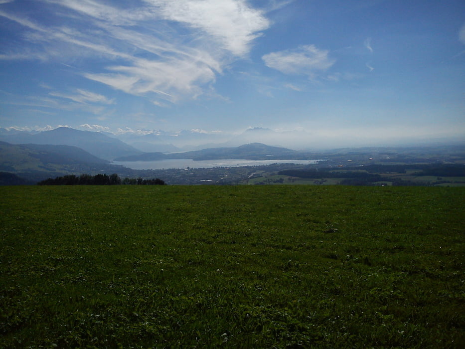
Der Ausblick auf den Zürichsee,  auf den Zugersee, oder sogar auf beide gleichzeitig sind die schönste Panoramen auf der Tour.

Ab Sihlbrugg aber eher langweilig, da es nur der Strasse entlang zum Zielpunkt geht. :-)


Galeria trasy

Mapa trasy i profil wysokości

  • Open Street Map
  • Google
Minimum height 298 m Maximum height 963 m Widok szczegółowy

More about the tour author

olipeh
Member since 2008

Send private message

Komentarze

GPS tracks

Trackpoints
  • GPX / Garmin Map Source (gpx) download
  • TCX / Garmin Training Center® (tcx) download
  • CRS / Garmin Training Center® (crs) download
  • Google Earth (kml) download
  • G7ToWin (g7t) download
  • TTQV (trk) download
  • Overlay (ovl) download
  • Fugawi (txt) download
  • Kompass (DAV) Track (tk) download
  • Karta trasy (pdf) download
  • Original file of the author (gpx) download

More about the tour author

olipeh
Member since 2008

Send private message
Share track
Add to my favorites
Remove from my favorites
Edit tags
My score
Rate
Trasa: Zufikon-ütlieberg-Albishoehe-Sihlbrugg-Zufikon
Rodzaj: Rower górski (MTB)
Długość: 61,9 km
Evaluated on:
Czas trwania:
Day(s)
Hour(s)
Minute(s)
Ocena: Krajobraz Czynnik zadowolenia Kondycja Technika