


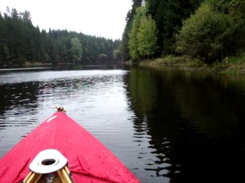
unser Start ist am Bootsanlegesteg wo wir bequem das Faltboot zusammenbauen.
ab hier ist alles möglich, je nach Zeit und Lust kann man bis zum Campingplatz ganz im Osten padeln. Kältebedingt ( 8 ° ) wurde es heute nur eine kurze Tour.
nach Westen soll das militärische Gebiet Allensteig anfangen.
Further information at
http://www.ottensteinersee.at/Galeria trasy


Mapa trasy i profil wysokości
Minimum height 452 m
Maximum height 461 m
More about the tour author

|
ghostrider36 |
Komentarze

im Navi Mitterreith eingeben, durch Mitterreith durch, dann rechts abbiegen und noch einen km weiter, hier gibt es auch genügend Parkplätze:
N 48 36.934, E 15 15.498
Danach gab es im gemütlichen und rustikalen Gasthaus Hanni einen sehr netten Ausklang.
GPS tracks
Trackpoints-
GPX / Garmin Map Source (gpx) download
-
TCX / Garmin Training Center® (tcx) download
-
CRS / Garmin Training Center® (crs) download
-
Google Earth (kml) download
-
G7ToWin (g7t) download
-
TTQV (trk) download
-
Overlay (ovl) download
-
Fugawi (txt) download
-
Kompass (DAV) Track (tk) download
-
Karta trasy (pdf) download
-
Original file of the author (gpx) download
More about the tour author
|
|
ghostrider36 |
Add to my favorites
Remove from my favorites
Edit tags
Open track
My score
Rate