Login

Zapomniałeś swój login?

Cookies have to be accepted!
Your browser's cookie functionality is disabled. Please enable this functionality.

Not a member yet?

Register now
Login

Available for registred users only

Log in to use this feature.

Zapomniałeś swój login?

Cookies have to be accepted!
Your browser's cookie functionality is disabled. Please enable this functionality.

Not a member yet?

Register now
Filter
Kategorie
Advanced filters
  • Długość (km)
  • Wysokość
Zapisz filtr Reset filter

TrackRank

QRCode

Technical data

Długość49,4 km Wysokość1569 m Way down1567 m Czas trwania05:00 h:m Data16.10.2010
Oceny Author Krajobraz Czynnik zadowolenia Kondycja Technika

Statystyka

1141 Widoki Oceny 200 Downloads / Pliki do pobrania Przeciętnie
Rate
  • Karta trasy
  • Dojazd
  • Downloads / Pliki do pobrania

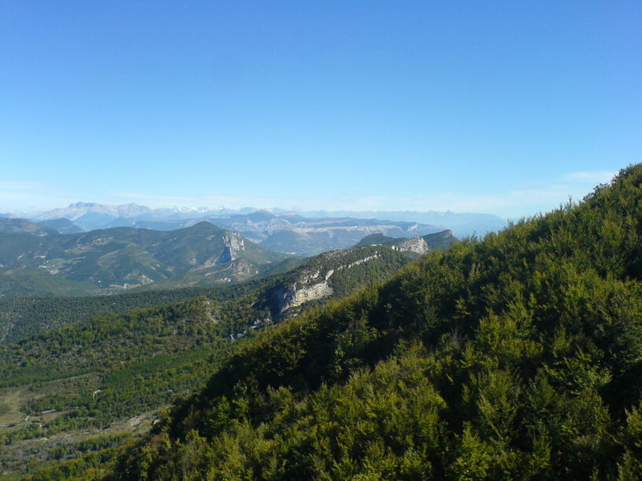
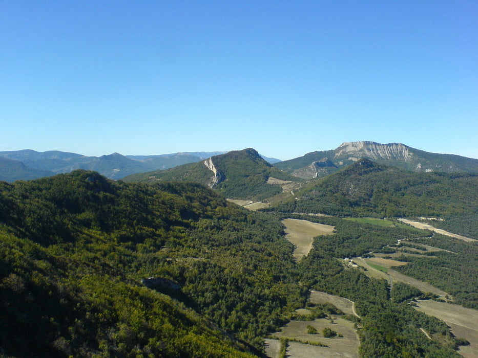
Auf der Strasse von Orpierre nach Sante Colombe. Weiter auf einsamen Wanderwegen zum Col St. Jean. Auf Schotterwegen über Ballons zum Panoramagipfel Chabre, letztes Stück auf Asphalt. Supertrail vom Gipfel ins Tal (S1), oben steinig, wird nach unten immer besser.

Galeria trasy

Mapa trasy i profil wysokości

  • Open Street Map
  • Google
Minimum height 618 m Maximum height 1321 m Widok szczegółowy

More about the tour author

radrige
Member since 2008

Send private message

Komentarze

riemchens on 10.10.2011

outdoor pur

Diese beiden Täler, sowohl das Tal von Orpierre als auch das Tal der Meouge sind einfach grandios. In Orpierre treffen sich die Kletterer, in Taler der Meouge die Drachenflieger, und diese Mountainbiketour liest sich auch nicht schlecht. Ich war im Tal der Meouge Flusswandern. Wer "outdoor" etwas mach will, ist hier genau richtig.

GPS tracks

Trackpoints
  • GPX / Garmin Map Source (gpx) download
  • TCX / Garmin Training Center® (tcx) download
  • CRS / Garmin Training Center® (crs) download
  • Google Earth (kml) download
  • G7ToWin (g7t) download
  • TTQV (trk) download
  • Overlay (ovl) download
  • Fugawi (txt) download
  • Kompass (DAV) Track (tk) download
  • Karta trasy (pdf) download
  • Original file of the author (gpx) download

More about the tour author

radrige
Member since 2008

Send private message
Share track
Add to my favorites
Remove from my favorites
Edit tags
My score
Rate
Trasa: Rundtour bei Orpierre
Rodzaj: Rower górski (MTB)
Długość: 49,4 km
Evaluated on:
Czas trwania:
Day(s)
Hour(s)
Minute(s)
Ocena: Krajobraz Czynnik zadowolenia Kondycja Technika