Login

Zapomniałeś swój login?

Cookies have to be accepted!
Your browser's cookie functionality is disabled. Please enable this functionality.

Not a member yet?

Register now
Login

Available for registred users only

Log in to use this feature.

Zapomniałeś swój login?

Cookies have to be accepted!
Your browser's cookie functionality is disabled. Please enable this functionality.

Not a member yet?

Register now
Filter
Kategorie
Advanced filters
  • Długość (km)
  • Wysokość
Zapisz filtr Reset filter

TrackRank

QRCode

Technical data

Długość11,6 km Wysokość630 m Way down628 m Czas trwania04:00 h:m Data17.10.2010
Oceny Author User Krajobraz Czynnik zadowolenia Kondycja Technika

Statystyka

2125 Widoki 3 Oceny 286 Downloads / Pliki do pobrania 3.67 Przeciętnie
Rate
  • Karta trasy
  • Dojazd
  • Downloads / Pliki do pobrania

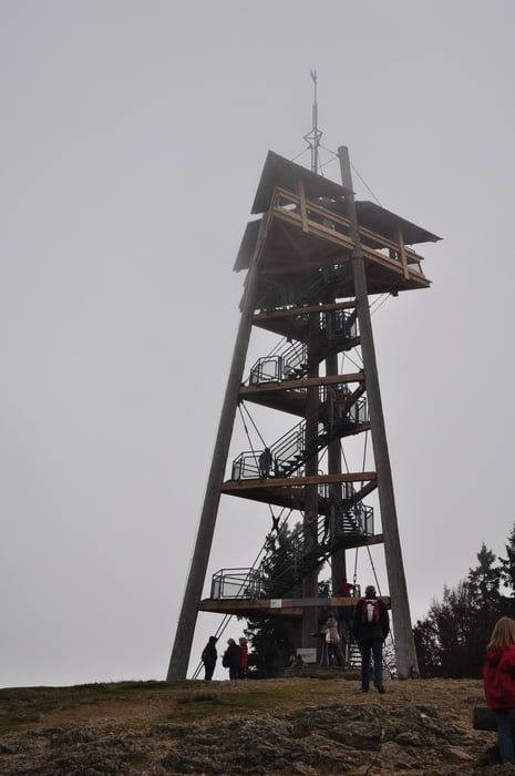
Vom Parkplatz beim Gasthaus (selten offen) an der Holzschlägermattkurve Richtung Norden bis zum Kohlerbau und dann Aufwärts zum Schauinslandturm ( herrliche Aussicht) und dann abwärts bis zur Eduardshöhe und etwas zurück gehen und weiter zum Parkplatz.

Galeria trasy

Mapa trasy i profil wysokości

  • Open Street Map
  • Google
Minimum height 820 m Maximum height 1277 m Widok szczegółowy

More about the tour author

Lohrer
Member since 2009

Send private message

Komentarze

wanderer37 on 14.08.2014

Rundwanderung Schauinsland

Rückweg existiert nicht mehr!

Freiburg - Günterstal - Schauinsland

GPS tracks

Trackpoints
  • GPX / Garmin Map Source (gpx) download
  • TCX / Garmin Training Center® (tcx) download
  • CRS / Garmin Training Center® (crs) download
  • Google Earth (kml) download
  • G7ToWin (g7t) download
  • TTQV (trk) download
  • Overlay (ovl) download
  • Fugawi (txt) download
  • Kompass (DAV) Track (tk) download
  • Karta trasy (pdf) download
  • Original file of the author (gpx) download

More about the tour author

Lohrer
Member since 2009

Send private message
Share track
Add to my favorites
Remove from my favorites
Edit tags
My score
Rate
Trasa: Rundwanderung Schauinsland
Rodzaj: Wędrówki
Długość: 11,6 km
Evaluated on:
Czas trwania:
Day(s)
Hour(s)
Minute(s)
Ocena: Krajobraz Czynnik zadowolenia Kondycja Technika