Login

Zapomniałeś swój login?

Cookies have to be accepted!
Your browser's cookie functionality is disabled. Please enable this functionality.

Not a member yet?

Register now
Login

Available for registred users only

Log in to use this feature.

Zapomniałeś swój login?

Cookies have to be accepted!
Your browser's cookie functionality is disabled. Please enable this functionality.

Not a member yet?

Register now
Filter
Kategorie
Advanced filters
  • Długość (km)
  • Wysokość
Zapisz filtr Reset filter

TrackRank

QRCode

Technical data

Długość4,7 km Wysokość278 m Way down251 m Czas trwania02:00 h:m Data23.10.2010
Oceny Author Krajobraz Czynnik zadowolenia Kondycja Technika

Statystyka

687 Widoki Oceny 208 Downloads / Pliki do pobrania Przeciętnie
Rate
  • Karta trasy
  • Dojazd
  • Downloads / Pliki do pobrania

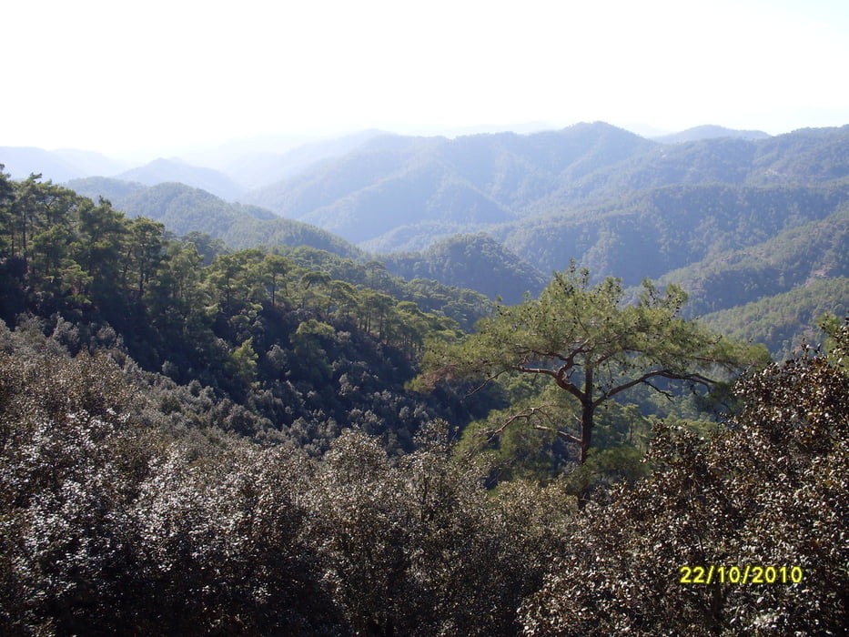
Rundweg oberhalb von Stavros tis Psokas. Schöne Ausblicke ins Stavrostal und auf die Forststation. Dichter Baumbestand mit Kiefern und Goldeichen. Am Startpunkt kann man sich an einem Brunnen den Wasservorrat auffüllen.

Galeria trasy

Mapa trasy i profil wysokości

  • Open Street Map
  • Google
Minimum height 929 m Maximum height 1209 m Widok szczegółowy

More about the tour author

Keschtewaeldele
Member since 2008

Send private message

Komentarze

Startpunkt und Parken: Platanoudkia, etwa auf halber Strecke zwischen Stavros tis Psokas und der Straße nach Selladi tou Stavrou. 

GPS tracks

Trackpoints
  • GPX / Garmin Map Source (gpx) download
  • TCX / Garmin Training Center® (tcx) download
  • CRS / Garmin Training Center® (crs) download
  • Google Earth (kml) download
  • G7ToWin (g7t) download
  • TTQV (trk) download
  • Overlay (ovl) download
  • Fugawi (txt) download
  • Kompass (DAV) Track (tk) download
  • Karta trasy (pdf) download
  • Original file of the author (gpx) download

More about the tour author

Keschtewaeldele
Member since 2008

Send private message
Share track
Add to my favorites
Remove from my favorites
Edit tags
My score
Rate
Trasa: Chorteri-Rundweg
Rodzaj: Wędrówki
Długość: 4,7 km
Evaluated on:
Czas trwania:
Day(s)
Hour(s)
Minute(s)
Ocena: Krajobraz Czynnik zadowolenia Kondycja Technika