


Diese kleine Tour läßt sich besonders an heißen Tagen prima einfügen, da nahezu der gesamte Weg durch dichten Blätterwald führt. Hier, zwischen Stauden, hohen Bäumen und riesigen Gräsern herrscht ein angenehmes Klima, besonders, weil der Boden häufig naß ist.
Die Markierung des Weges ist doch eher "schlicht". Im Rother Wanderführer wird zwar von weissen Markierungen an Steinen und auf dem Boden geschrieben, diese sind aber eher sporadisch anzufinden. So richtig verlaufen kann man sich hier aber nicht. Wo eine "Attraktion" ist, ist auch ein Weg.
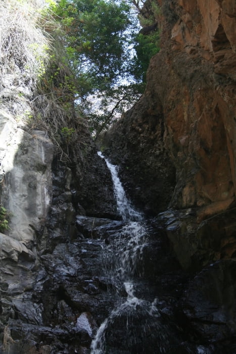
Der Wasserfall ist im Hochsommer dürftig, aber im Frühjahr strömt er üppig über die Kante herab. Die Gischt tut gut und die Location läd auch wegen der zahlreichen Libellen zum Verweilen ein
Galeria trasy


Mapa trasy i profil wysokości
Minimum height 163 m
Maximum height 344 m
More about the tour author
|
|
tom_ac |
Komentarze

GPS tracks
Trackpoints-
GPX / Garmin Map Source (gpx) download
-
TCX / Garmin Training Center® (tcx) download
-
CRS / Garmin Training Center® (crs) download
-
Google Earth (kml) download
-
G7ToWin (g7t) download
-
TTQV (trk) download
-
Overlay (ovl) download
-
Fugawi (txt) download
-
Kompass (DAV) Track (tk) download
-
Karta trasy (pdf) download
-
Original file of the author (gpx) download
More about the tour author
|
|
tom_ac |
Add to my favorites
Remove from my favorites
Edit tags
Open track
My score
Rate