


Date: January 1, 2011
Start: 1701 m (Heiligenblut Cable Car Middle Station)
Finish: 1701 m (Heiligenblut Cable Car Middle Station)
Highest point: 1960 m (Schöneck)
Lowest point: 1698 m
Total ascent: 416 m
Total descent: 416 m
Information about the Grossglockner Hochalpenstrasse:
http://www.grossglockner.at/
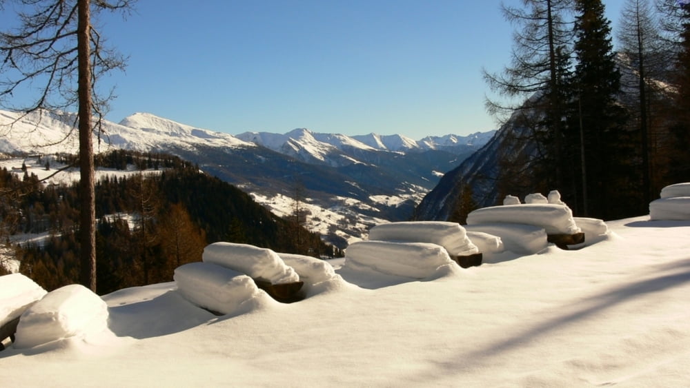
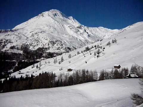
We decided to explore the Grossglockner Hochalpenstrasse like we have never before - during the winter, when it is closed to traffic. So we rented snowshoes in Heiligenblut and set off for a nice walk from the middle station of the Schareck Cable Car, walked all the way to Schöneck and back.
Amazing walk with breathtaking views!!!!!
Further information at
http://www.beepee.hu/v/turak/ausztria1012/hotalp_2011_01_01Galeria trasy


Mapa trasy i profil wysokości
Minimum height 1699 m
Maximum height 1961 m
More about the tour author
|
|
beepee |
Komentarze

Places where you can eat and drink:
Heiligenblut
Schareck cable car middle station
Kasereck is closed for the winter!!!
Route:
1. park you car at the Toll Station of the Hochalpenstrasse, or at the Middle Station.
2. continue your trip walking on the Hochalpenstrasse
3. be careful, from the middle station until Kasereck, you are walking on a Skiroute!!
4. at Kasereck, put on you snowshoes and follow the path of the road
5. at the roundabout, turn left (towards Kaiser Franz Josefs Höhe)
6. at Schöneck, stop to take a look at the Pasterze Glacier, and turn back
7. follow the same road on the way back
GPS tracks
Trackpoints-
GPX / Garmin Map Source (gpx) download
-
TCX / Garmin Training Center® (tcx) download
-
CRS / Garmin Training Center® (crs) download
-
Google Earth (kml) download
-
G7ToWin (g7t) download
-
TTQV (trk) download
-
Overlay (ovl) download
-
Fugawi (txt) download
-
Kompass (DAV) Track (tk) download
-
Karta trasy (pdf) download
-
Original file of the author (gpx) download
More about the tour author
|
|
beepee |
Add to my favorites
Remove from my favorites
Edit tags
Open track
My score
Rate