
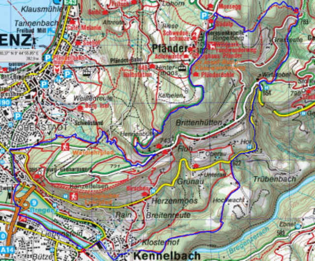

Start bei der Achbrücke in Kennelbach zum Weidachknoten und über die Rodelbahn zum Pfänder. Abfahrt über Spezialstrecke ins Wirtatobel, und dann über Forststrasse zurück nach Kennelbach. Gefährliche Stelle bei WP1, besonders bei Nässe, auch für Profis vorherige Besichtigung empfohlen. Für Leute ohne GPS: bei der Abfahrt Markierung ws-rt-ws folgen und bei der letzten Dreiergabelung die rechte Abzweigung nehmen (kurz vor WP1).
Further information at
http://klauserg.dyndns.org/1701_index_sport_bike.php#ziel1Mapa trasy i profil wysokości
Minimum height 413 m
Maximum height 1009 m
More about the tour author

|
klauserg |
Komentarze

Kurztour mit technisch anspruchsvoller Abfahrt
GPS tracks
Trackpoints-
GPX / Garmin Map Source (gpx) download
-
TCX / Garmin Training Center® (tcx) download
-
CRS / Garmin Training Center® (crs) download
-
Google Earth (kml) download
-
G7ToWin (g7t) download
-
TTQV (trk) download
-
Overlay (ovl) download
-
Fugawi (txt) download
-
Kompass (DAV) Track (tk) download
-
Karta trasy (pdf) download
-
Original file of the author (gpx) download
More about the tour author
|
|
klauserg |
Add to my favorites
Remove from my favorites
Edit tags
Open track
My score
Rate