


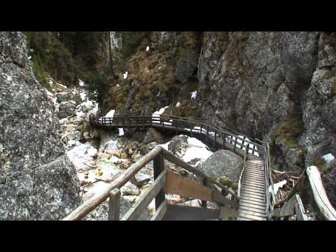
Vom Parkplatz geht es durch die enge Klamm z.T. steiler hinauf. Der ganze Weg führt über Fels und Holzplanken mit Trittleisten, meist mit Geländer, das aber aktuell an einigen Stellen beschädigt war. Bei Eis/ Tiefschnee nicht empfehlenswert! (gesperrt).
Am Ende der Klamm kann man noch das kurze Stück zur Silberkarhütte (beim Begehen 2011 Mitte März noch tiefer Schnee) zurücklegen: herrlicher Ausblick in steile Wände und rückwärts zu den Tauern.
Galeria trasy


Mapa trasy i profil wysokości
Minimum height 1003 m
Maximum height 1224 m
More about the tour author
|
|
heinz-57 |
Komentarze

Google Earth: 47°26'3.13"N / 13°43'4.73"E
Von Ramsau- Ort gen Osten nach Rössing, am Dorfanfang ("zum Lodenwalker") nach links Schotterstraße zum Parkplatz. Eintritt (Saison) € 2,70.
GPS tracks
Trackpoints-
GPX / Garmin Map Source (gpx) download
-
TCX / Garmin Training Center® (tcx) download
-
CRS / Garmin Training Center® (crs) download
-
Google Earth (kml) download
-
G7ToWin (g7t) download
-
TTQV (trk) download
-
Overlay (ovl) download
-
Fugawi (txt) download
-
Kompass (DAV) Track (tk) download
-
Karta trasy (pdf) download
-
Original file of the author (gpx) download
More about the tour author
|
|
heinz-57 |
Add to my favorites
Remove from my favorites
Edit tags
Open track
My score
Rate