
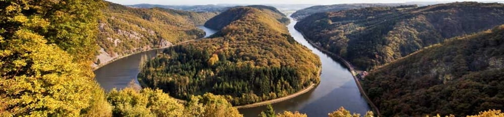

Randonnée au milieu du parc naturel de la Sarre dans une nature préservée. De petits chemins étroits et abrupts au bord de corniches avec une magnifique vue sur les boucles de la Sarre. Une visite (gratuite) du Wolf Park (parc avec des loups en semi-liberté) est possible au départ ou à l'arrivée.
Pour se donner une idée:
http://www.wolfspark-wernerfreund.de/.
http://www.visiter-la-sarre.fr/fr/description-de-la-randonnee-saar-hunsrueck-steig
http://www.wanderbares-saarland.de/wanderwege/saarschleifentour.html
Galeria trasy


Mapa trasy i profil wysokości
Minimum height 152 m
Maximum height 377 m
More about the tour author

|
snoup57 |
Komentarze

GPS tracks
Trackpoints-
GPX / Garmin Map Source (gpx) download
-
TCX / Garmin Training Center® (tcx) download
-
CRS / Garmin Training Center® (crs) download
-
Google Earth (kml) download
-
G7ToWin (g7t) download
-
TTQV (trk) download
-
Overlay (ovl) download
-
Fugawi (txt) download
-
Kompass (DAV) Track (tk) download
-
Karta trasy (pdf) download
-
Original file of the author (gpx) download
More about the tour author
|
|
snoup57 |
Add to my favorites
Remove from my favorites
Edit tags
Open track
My score
Rate