Login

Zapomniałeś swój login?

Cookies have to be accepted!
Your browser's cookie functionality is disabled. Please enable this functionality.

Not a member yet?

Register now
Login

Available for registred users only

Log in to use this feature.

Zapomniałeś swój login?

Cookies have to be accepted!
Your browser's cookie functionality is disabled. Please enable this functionality.

Not a member yet?

Register now
Filter
Kategorie
Advanced filters
  • Długość (km)
  • Wysokość
Zapisz filtr Reset filter

TrackRank

QRCode

Technical data

Długość8,4 km Wysokość546 m Way down511 m Czas trwania00:02 h:m Data01.05.2007
Oceny Author Krajobraz Czynnik zadowolenia Kondycja Technika

Statystyka

3605 Widoki 1 Ocena 193 Downloads / Pliki do pobrania 4.00 Przeciętnie
Rate
  • Karta trasy
  • Dojazd
  • Downloads / Pliki do pobrania
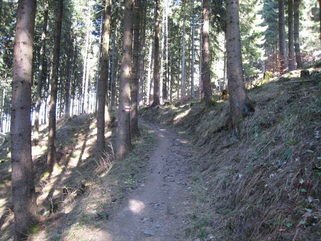
Knackige Feierabend-Singletrailtour. Gnadenloser Anstieg ohne Pause oder Erholungsstrecken von 550 Höhenmetern. Das wird dann aber von einem super Singletrail belohnt.

Die Tourdauer ist inklusive Gemütlichkeits- uns Spassfaktor angegeben.

Galeria trasy

Mapa trasy i profil wysokości

  • Open Street Map
  • Google
Minimum height 452 m Maximum height 1011 m Widok szczegółowy

More about the tour author

rrick

Komentarze

GPS tracks

Trackpoints
  • GPX / Garmin Map Source (gpx) download
  • TCX / Garmin Training Center® (tcx) download
  • CRS / Garmin Training Center® (crs) download
  • Google Earth (kml) download
  • G7ToWin (g7t) download
  • TTQV (trk) download
  • Overlay (ovl) download
  • Fugawi (txt) download
  • Kompass (DAV) Track (tk) download
  • Karta trasy (pdf) download
  • Original file of the author (gpx) download

More about the tour author

rrick

Share track
Add to my favorites
Remove from my favorites
Edit tags
My score
Rate
Trasa: Paulahütte
Rodzaj: Rower górski (MTB)
Długość: 8,4 km
Evaluated on:
Czas trwania:
Day(s)
Hour(s)
Minute(s)
Ocena: Krajobraz Czynnik zadowolenia Kondycja Technika